
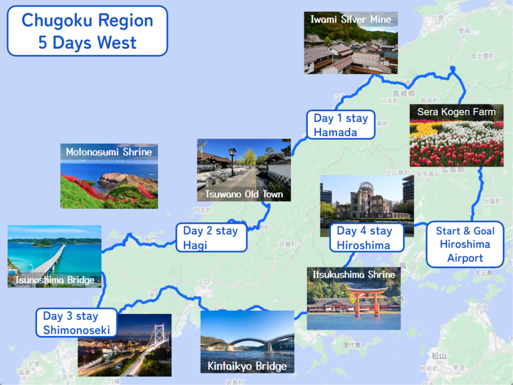
Summary
- Start
Hiroshima airport - Finish
Hiroshima airport - Mileage
Total 720km
145km per day - Travel Pace
Normal - Expressway Fee
About JPY5,000
It is a road trip itinerary for the west side of San’in Sanyo area in 5 days.
You can visit the charming historical town of Tsuwano, Hagi, 3 world heritage sites including Hiroshima atomic bomb dome and enjoy breathtaking driving along the mountain and seaside!
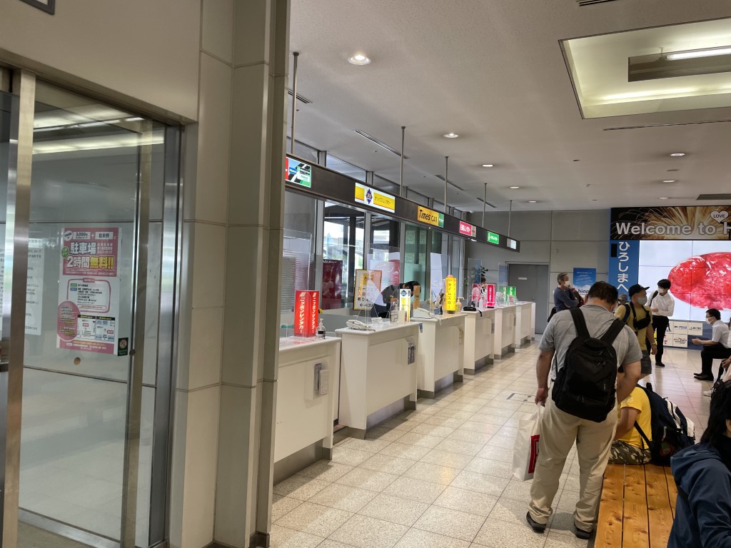
Rental Car
Rental car from Hiroshima Airport
5 rental car companies operate at the Hiroshima airport.
All company counters are located in front of the arrival hall of domestic flights.
- Nippon Rent-a-Car
7:00-21:30 - Toyota Rent a Car
8:00-20:00 - Orix Rent-a-Car
8:00-20:00 - Nissan Rent a Car
8:00-20:00 - Times Car Rental
8:00-20:00
Day 1 Hiroshima Airport – Hamada
Start: Hiroshima Airport (広島空港)
Finish: Hamada (浜田)
Mileage:170km
Travel Pace: Fast
On this day you are heading from Hiroshima Airport to Hamada via the UNESCO World Heritage Site of Iwami Ginzan Silver Mine Village.
Recommended Itinerary
1
Rental car branch at Hiroshima Airport
Parking MAPCODE:
9:00
Hiroshima Airport is the gateway to the Chugoku area. First of all, please complete the reception procedure at the rental car counter at the airport. It takes about 5 minutes by free shuttle bus to the rental car company branch.
The mileage of this day is about 170 km, and Iwami Ginzan Silver Mine is time-consuming. The trip is fast.
If your flights arrive late at night, you can stay in a hotel near the airport.
45 min
2
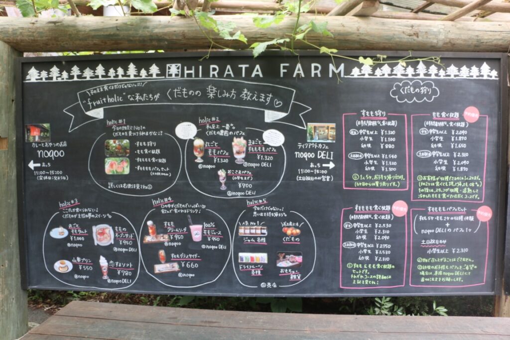
Hirata Fruit Farm
Parking MAPCODE:
267 035 780*57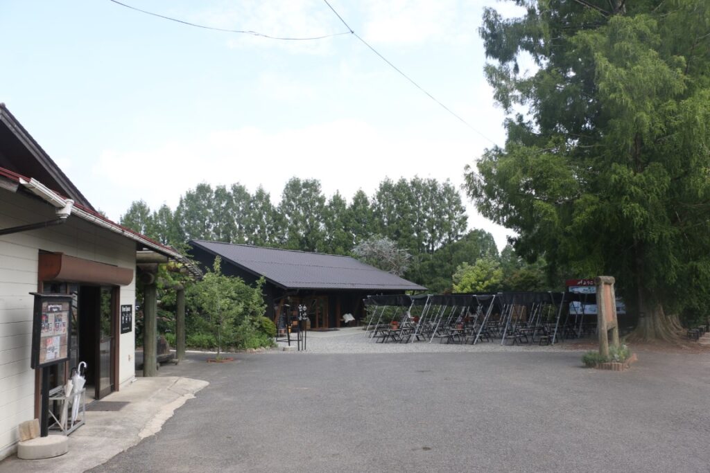
10:00
The first destination is [Hirata Fruit Farm].
This fruit farm is open the whole year, and you can enjoy fruit picking anytime!
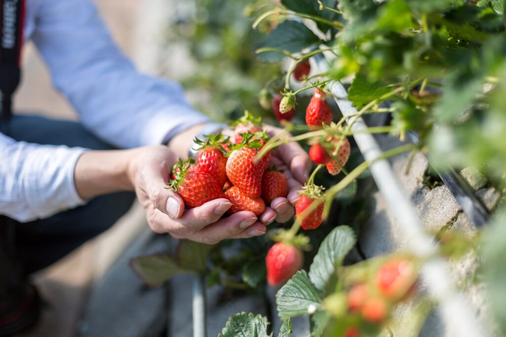
You can eat a variety of sweets, like parfaits, tarts, and ice cream, using their fresh fruits. Of course, you can also buy many fruit products like snacks, dried fruit, and jams.
Hirata Fruit Farm
110min
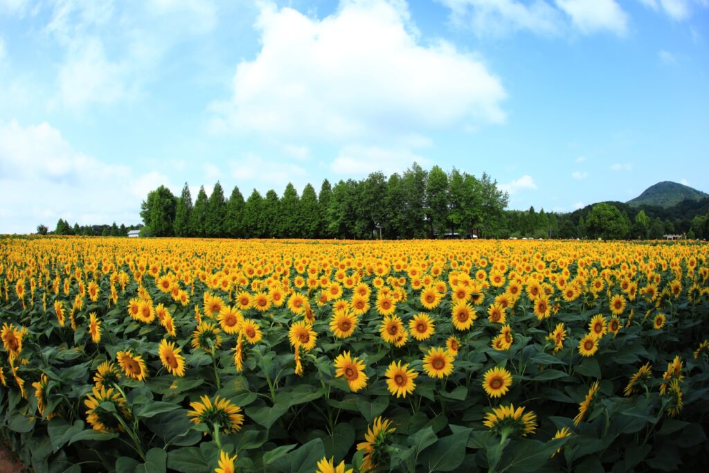
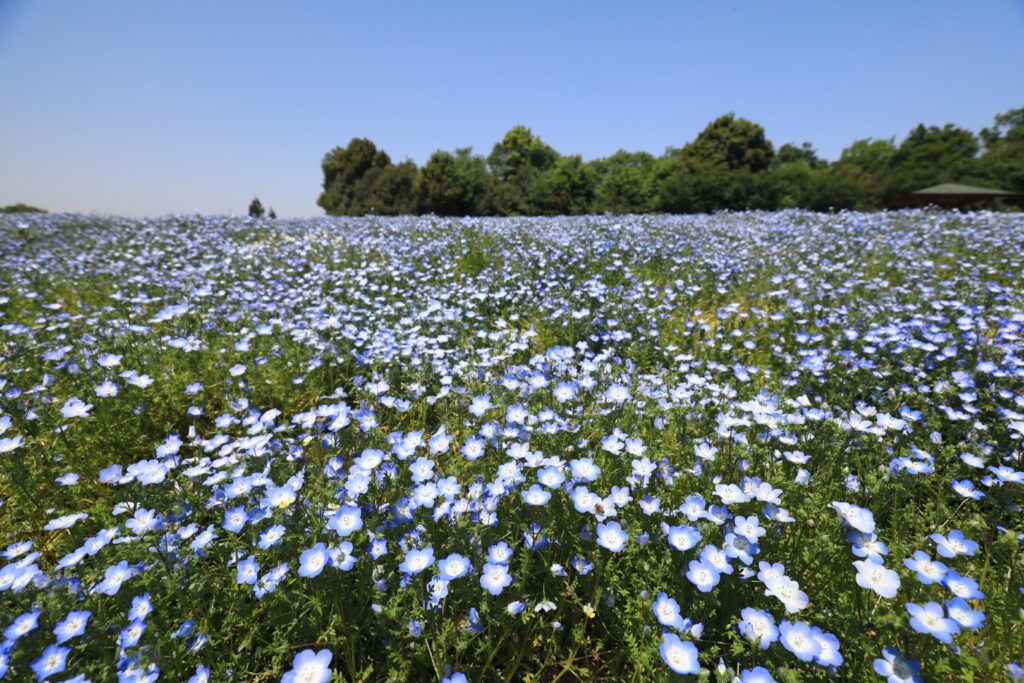
Around Hirata Fruit Farm, there are many nice flower gardens. Please refer Driving Map and if you travel flower season, it is highly recommended to visit these gardens.
The next spot, “Iwami Ginzan Silver Mine Village,” is located about 90 km away from here.
Please also refer to the driving map and take a break at a roadside station along the way.
Additionally, if you don’t have enough time to visit the next spots, you can consider taking expressway(E2A and E74) to head hotel in Hamada city directly.
3
Iwami Ginzan Silver Mine village
Parking MAPCODE:
Please refer below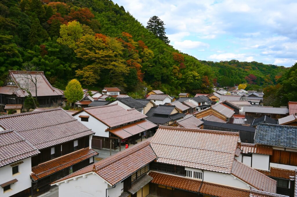
13:30
Today’s highlight is the UNESCO World Heritage Site [Iwami Ginzan Silver Mine Village].
The following parking lots are recommended:
①2nd Free Parking
MAPCODE: 599 144 182*37
②1st Free Parking
MAPCODE: 599 113 262*56
Please refer Google town map below.
Please refer Google town map below.
The process of refining silver requires large quantities of timber. In spite of this Iwami Ginzan Silber Mine is considered a “Suitable Industrial Historic site”, as it kept the environment in consideration during the production of silver.
(You need to walk 4 kilometers from the parking lot to the mine shaft)
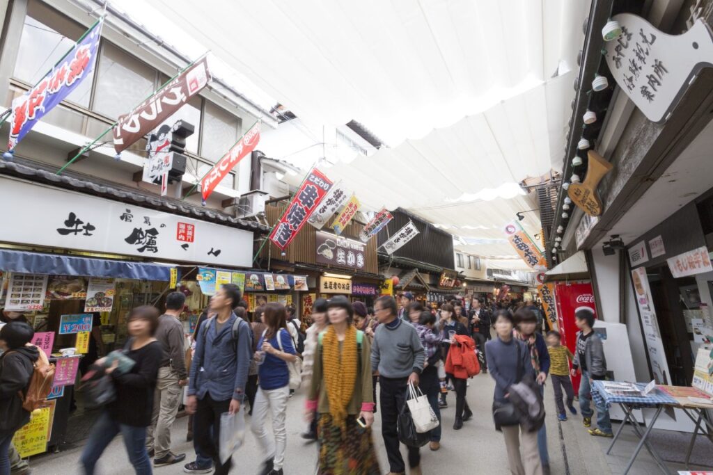
The town of Omori at the foot of the mountain is worth seeing.
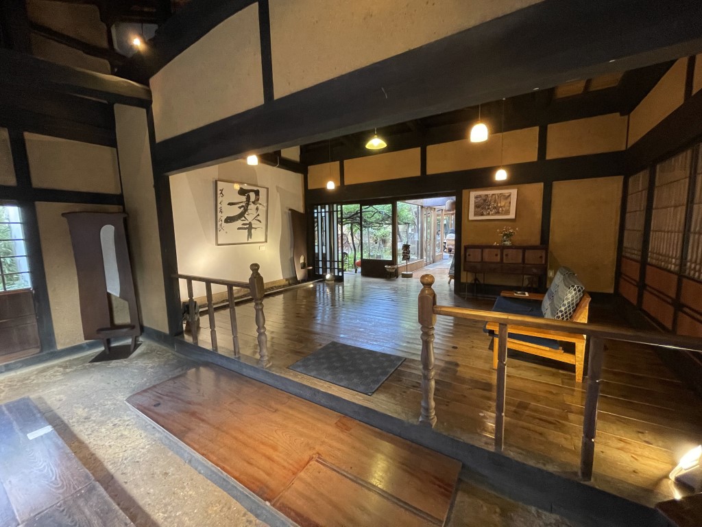
You can enjoy a stroll through the mansion with its hidden storehouse used for silver trading and the wonderful townscape. We also recommend lunch at a cafe that has been renovated from an old farmhouse.
Google Town map for Iwami Ginzan Silver Mine village
Iwami Ginzan Silver Mine village
60 min
4
Iwami Tatamigaura Beach
Parking MAPCODE:
241 373 637*17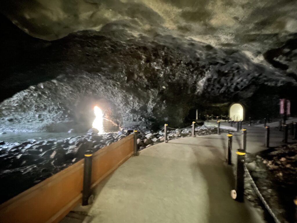
17:30
This is the last spot for this day.
It is an unknown scenic spot designated as a national natural monument. As you pass through the cool cave, the scenery of mysteriously shaped stones spreads out, giving you a feeling of exploration that is reminiscent of the shallow waters of the sea about 16 million years ago.
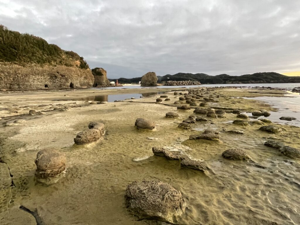
Iwami Tatamigaura Beach
20min
5
Inn in Hamada
There are many flower gardens along the way. Please refer to the driving map, and if you drive during flower season, it is highly recommended to visit!
Driving Map For the Day
The driving map will show an additional 10-20 spots for the day. You will travel only to your favorite spots. Click the pin on the map and input the parking MAPCODE into your car navigation system (GPS). It will guide you to the nearest parking lot for each spot!
Where to stay in Hamada
The inns are concentrated around Hamada station.
- Inn Type
Most of these inns are reasonable western-style hotels. - Parking
Some inns have official parking but in addition to the accommodation fee, the parking lot fee will be charged separately. - Meal Plan Reservations
Some restaurants are open till midnight but Hamada is not very big city. Youcan also book with dinner and breakfast.
Day 2 Hamada – Hagi
Start: Hamada (浜田)
Finish: Hagi (萩)
Mileage:130km
Travel Pace: Relax
On this day you will head from Hamada to Hagi.
Recommended Itinerary
2
Sesshu’s gardens and museum
Parking MAPCODE:
277 343 014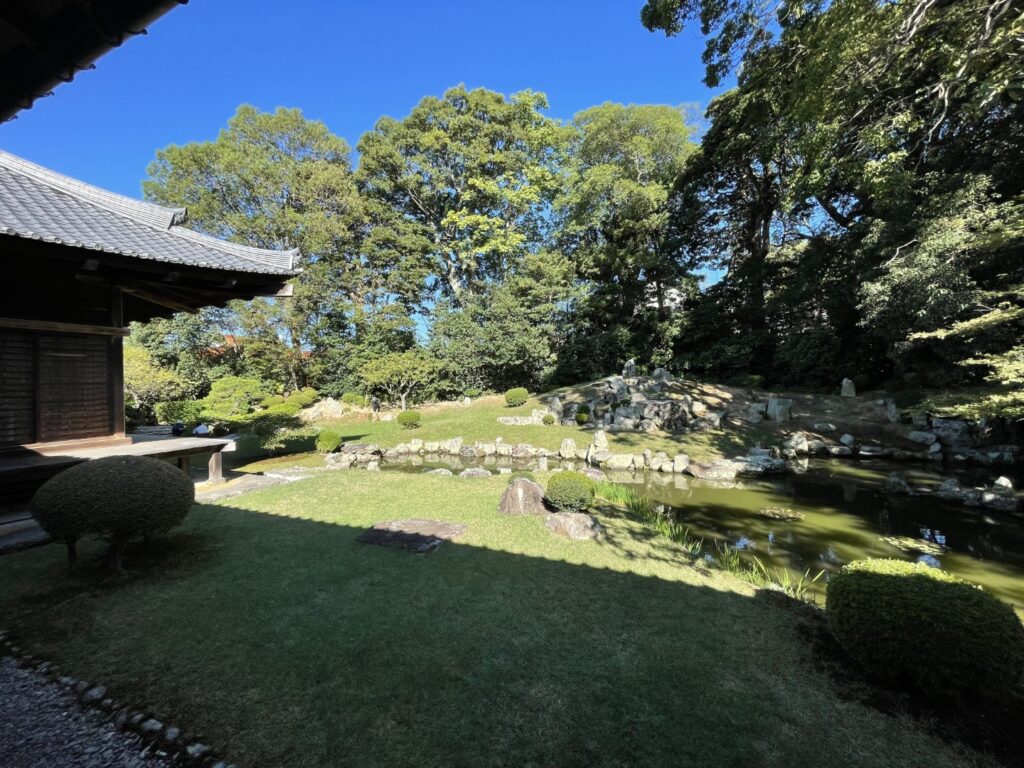
10:00
The first destination of the day is a Japanese garden.
Sesshu (1420–1502) was a Buddhist monk who is famous for painting and gardens. And there are three gardens and his museum.
The above MAPCODE is for Manpukuji Temple, and please refer to the map below for other gardens.
Map for 3 sesshu’s garden
Sesshu’s gardens and museum
50min
3
Tsuwano Old Town
Parking MAPCODE:
513 153 693*31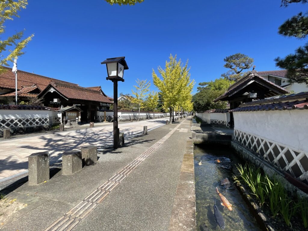
11:15
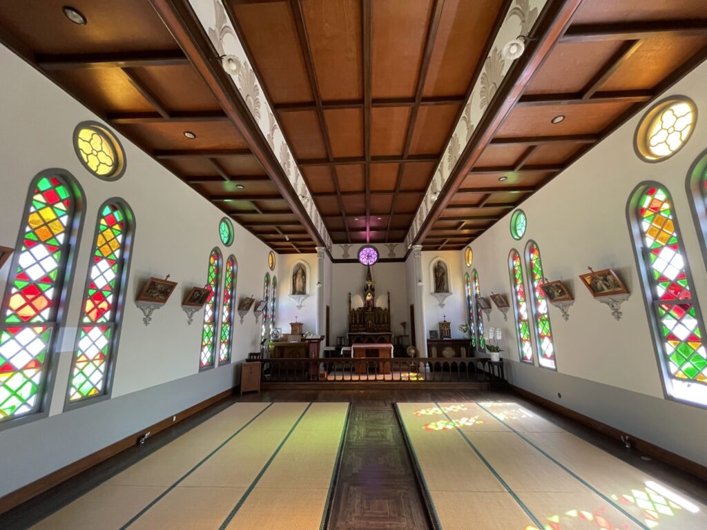
It is about 35 km to the next destination, “Tsuwano Old Town (津和野)”. Tsuwano, the day’s highlight, is a very beautiful old town with a moat where carp swim. There are Japanese-style Catholic churches that are worth visiting.
Tsuwano Town Map
Tsuwano Old Town
5min
4
Taikodani Inari Shrine
Parking MAPCODE:
513 152 378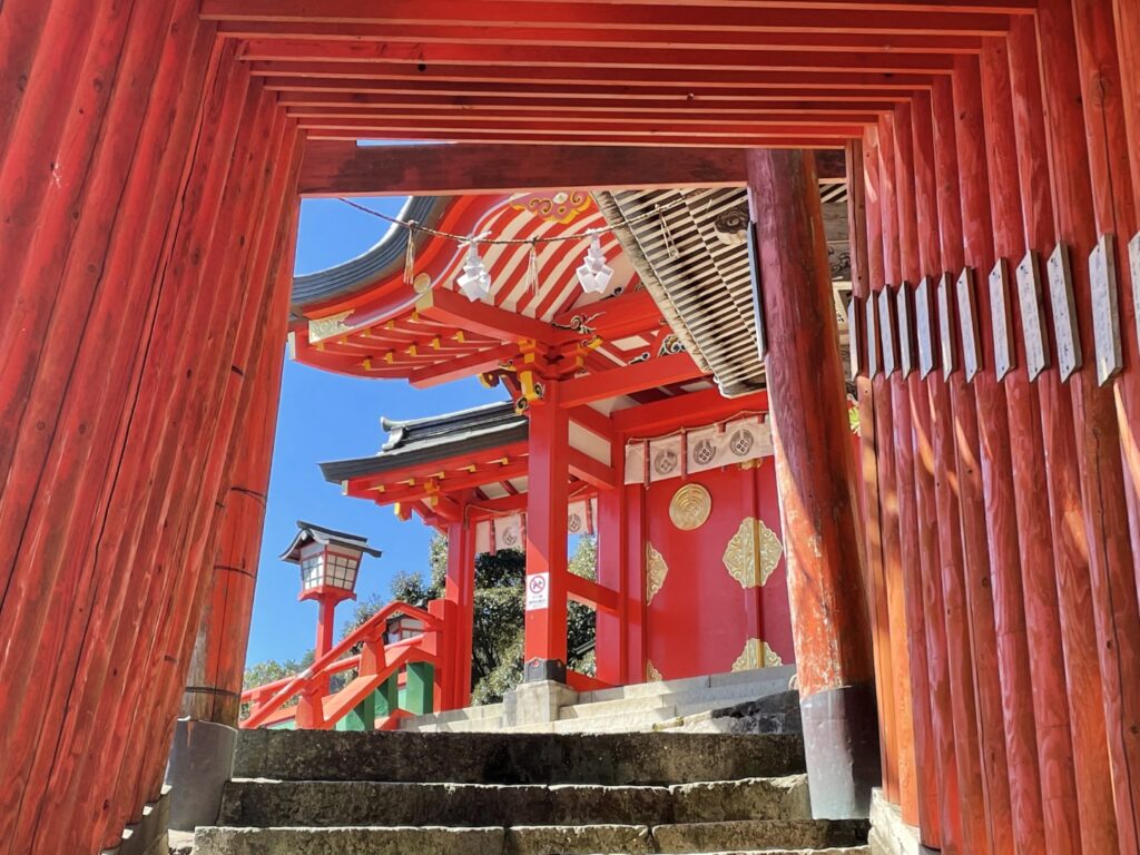
Another highlight of this day is “Taikodani Inari Shrine (太皷谷稲成神社)”. It is an undiscovered, very beautiful red shrine located on the hill, and you can look down on Tsuwano Town. The shrine also has a red torii gate tunnel with 263 steps. If you are fine walking, it is a great experience to walk from Tsuwano town to the shrine and to try to climb it.
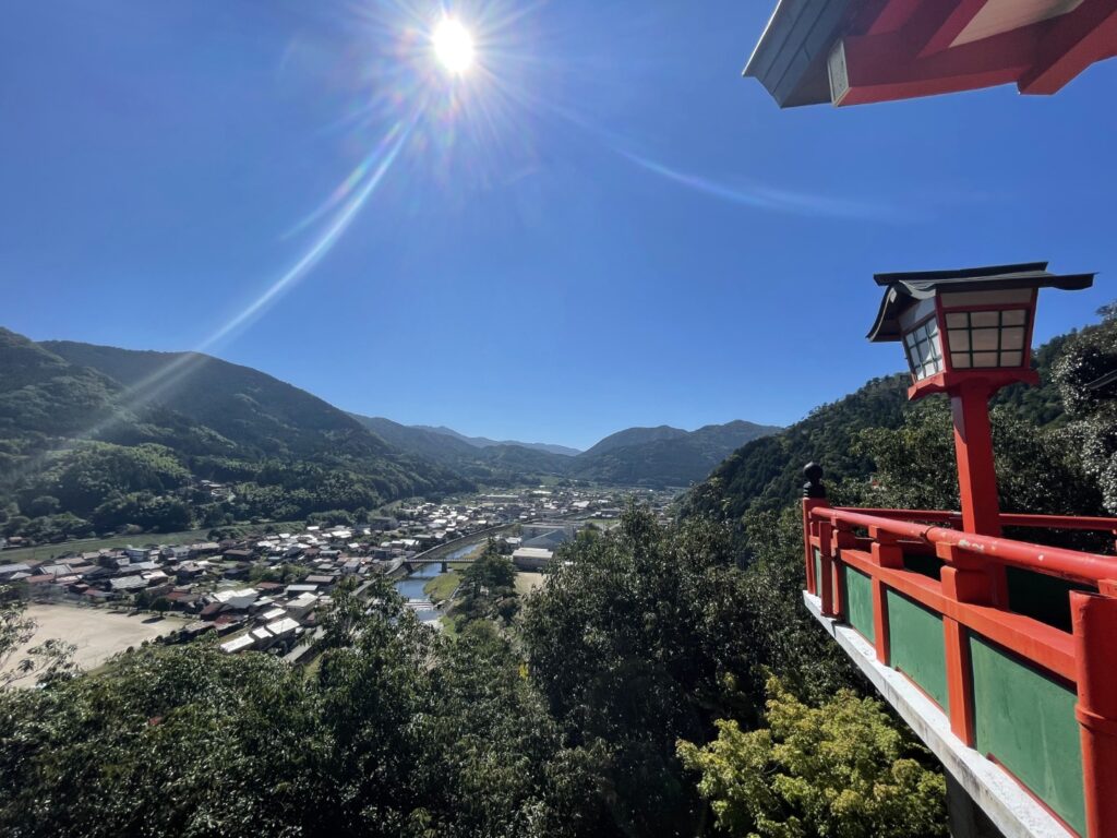
Taikodani Inari Shrine
45min
4
Chomonkyo Gorge
Parking MAPCODE:
870 277 667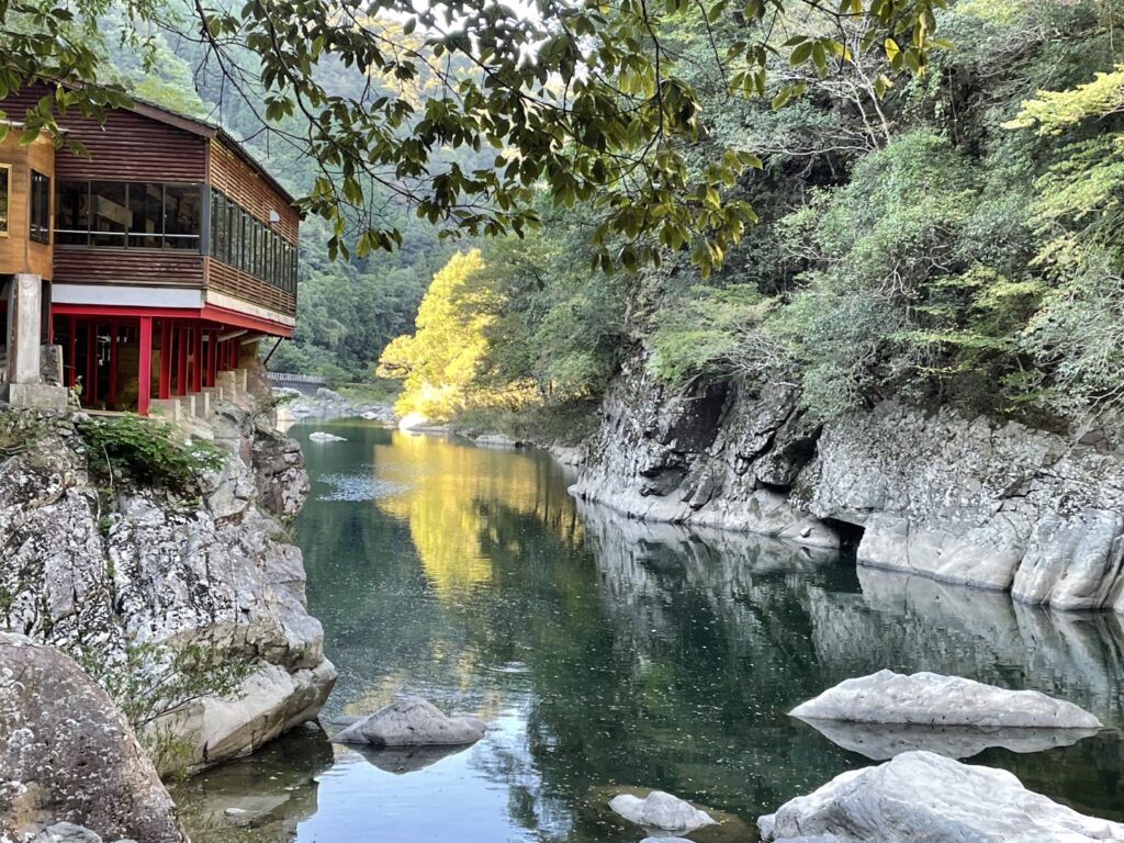
14:30
After Tsuwano, let’s head to “Chomonkyo Gorge (長門峡)”. It is a scenic spot designated as a national scenic spot in 1923.
And there is another reason why we recommend this spot. From this gorge to Hagi town, you can enjoy driving an unknown but beautiful route along the Abukawa River. If you are lucky, you may be able to watch wild monkeys too.
Chomonkyo Gorge
40min
5
Hagi Castle Town
Parking MAPCODE:
243 857 832*76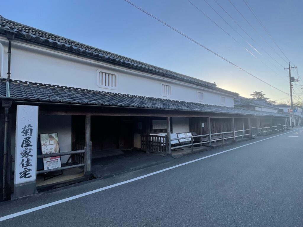
15:40
The last destination is Hagi Castle Town, where you will stay this day.
Hagi is a city that produced several famous samurai involved in Japan’s Meiji Restoration. In the castle town that extends from the outer moat of the former Hagi Castle, the town lines are divided in a grid pattern, and there are scattered houses such as merchant houses, intermediate samurai residences, and doctors’ houses. Even now, the town line remains as it was, and it retains the remnants of the past.
Hagi Town map
Hagi Castle Town
Driving Map For the Day
The driving map will show an additional 10-20 spots for the day. You will travel only to your favorite spots. Click the pin on the map and input the parking MAPCODE into your car navigation system (GPS). It will guide you to the nearest parking lot for each spot!
Where to stay in Hagi
The inns are spread over a wide area.
- Inn Type
Most of these inns are reasonable western-style hotels. - Parking
Some inns have official parking but in addition to the accommodation fee, the parking lot fee will be charged separately. - Onsen
A few inn have Onsens. - Meal Plan Reservations
There are some restaurants but not many. It is recommended to book with dinner and breakfast, or breakfast only.
Day 3 Hagi – Shimonoseki
Start: Hagi (萩)
Finish: Shimonoseki (下関)
Mileage:170km
Travel Pace: Fast
On this day you will head from Hagi to Shimonoseki.
Recommended Itinerary
1
Inn in Hagi
2
Akiyoshidai Karst Observatory
Parking MAPCODE:
243 216 627*55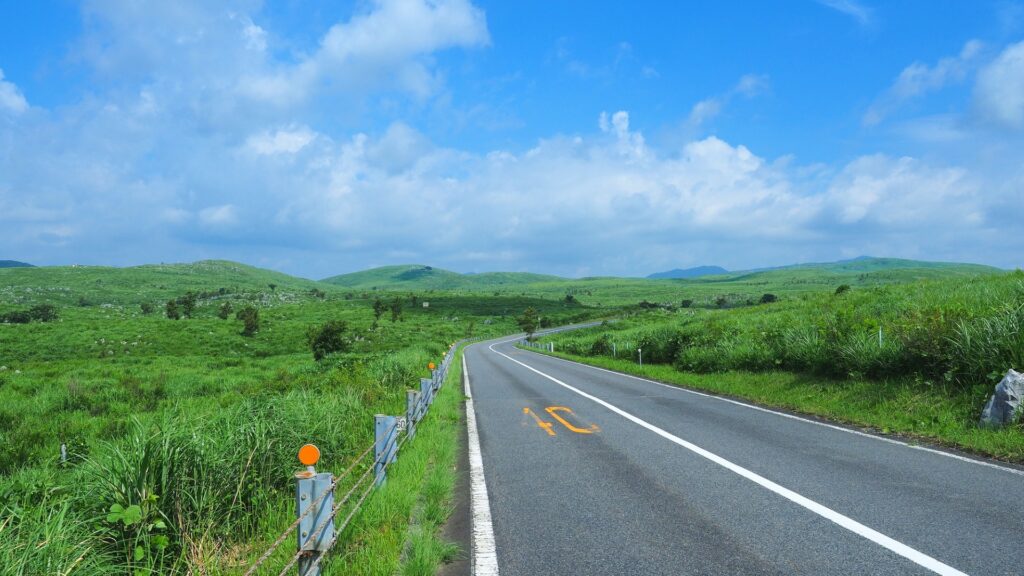
9:40
[Akiyoshidai Karst Observatory] yet, be sure to visit.
Akiyoshidai is the largest Karst plateau in Japan. Karst is a terrain created by the erosion of the earth, which is composed of easily meltable rocks such as limestone, rainwater, and groundwater. Akiyoshidai Karst Observatory is an observatory located in the southern part of Akiyoshidai. From the observatory, you can overlook the karst terrain and grasslands of Akiyoshidai.
You can enjoy breathtaking and exhilarating driving around Akiyoshidai Karst Observatory. Please refer to the below town map, and you can get a MAPCODE for this scenic drive.
Spot detailed map for Akiyoshidai Karst Observatory
Akiyoshidai Karst Observatory
5 min
3
Akiyoshido Limestone Cave
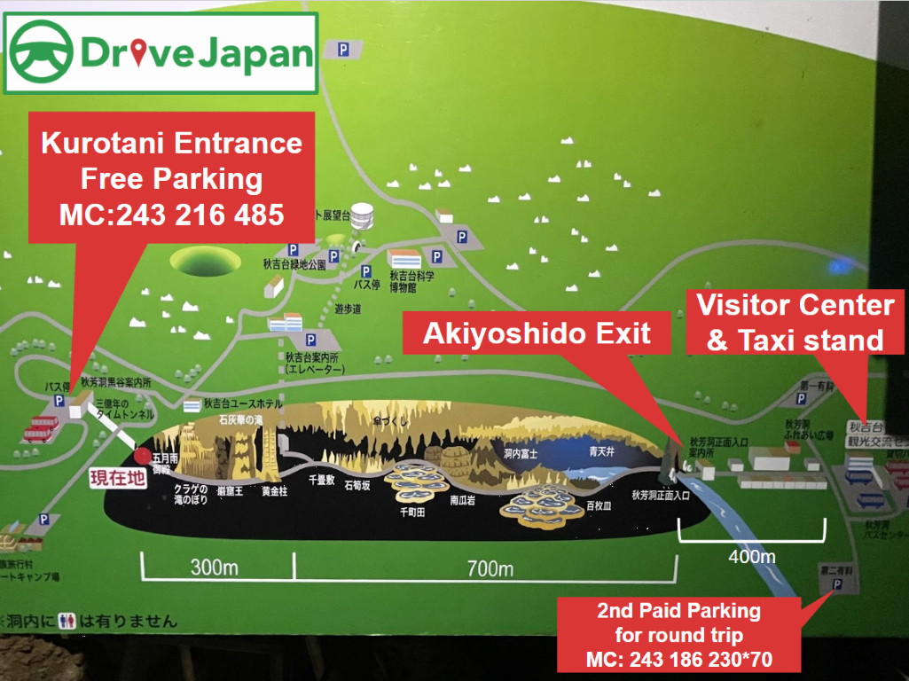
Parking MAPCODE:
243 216 485(Kurotani Entrance Parking)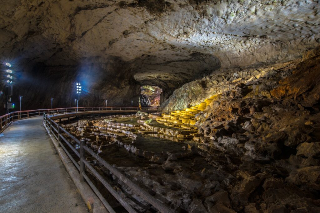
10:15
The first highlight of this day is Akiyoshido Limestone Cave, located 100 m underground in Akiyoshidai, one of the largest limestone caves in Japan.
Let’s go on an underground adventure with a total length of 1km and a height difference of 40m!
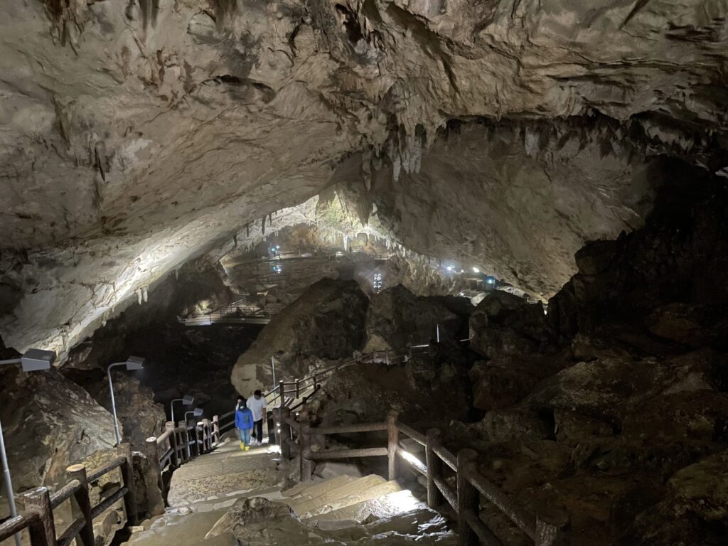
It takes 90min for a round trip and 60min for a one-way trip.
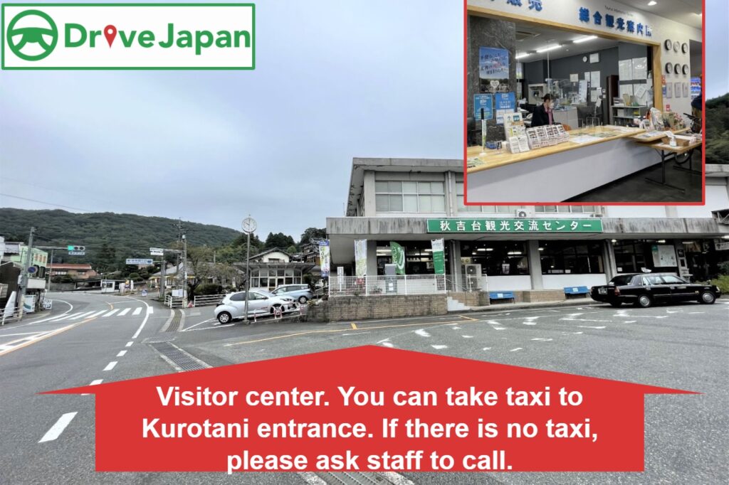
If you don’t have enough time, we recommend you to park and enter the cave from “Kurotani Entrance”. Once after exiting the other exit, “Akiyoshido Exit,” walk to the Visitor Center and take a taxi back to Kurotani Entrance.
Spot detailed map for Akiyoshido Limestone Cave
Akiyoshido Limestone Cave
70min
4
Motonosumi Shrine
Parking MAPCODE:
327 877 867*85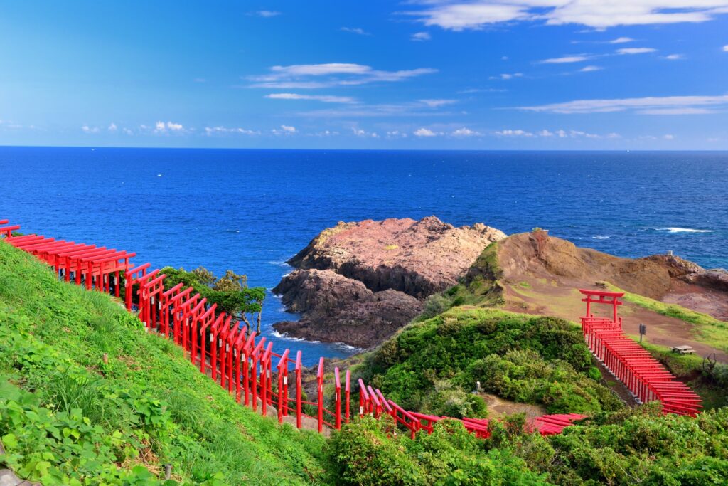
14:00
“Motonosumi Shrine (元乃隅神社)” is another must-visit spot. This shrine became famous when CNN selected it as one of the 31 most beautiful places in Japan in 2015. The red torii gate that stretches all the way to the sea is very beautiful and photogenic.
Motonosumi Shrine
5
Tsunoshima Bridge
Parking MAPCODE:
851 347 386*85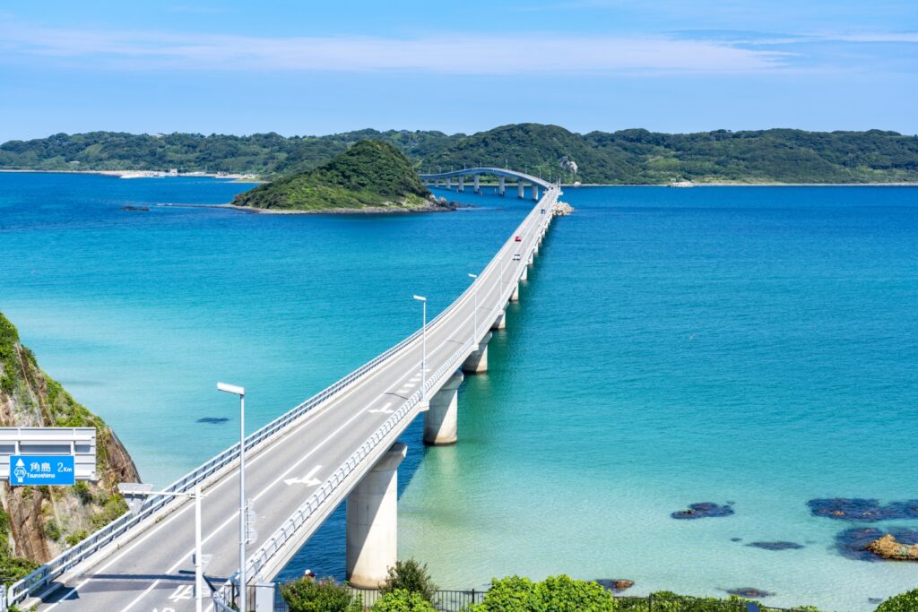
15:15
The best highlight of this day is the “Tsunoshima Bridge,” which is the very photogenic bridge connecting to Tsunoshima Island. You can enjoy very breath-taking driving scenery.
We also provide the MAPCODE for the observatory where you can look down the bridge above the MAPCODE. Please view the detailed map below.
Spot detailed map for Tsunoshima bridge
Tsunoshima Ohashi Bridge
90min
6
Inn in Shimonoseki
There are also recommended spots around Kanmon Strait where you can enjoy an evening. Please refer to our driving map.
Driving Map For the Day
The driving map will show an additional 10-20 spots for the day. You will travel only to your favorite spots. Click the pin on the map and input the parking MAPCODE into your car navigation system (GPS). It will guide you to the nearest parking lot for each spot!
Where to stay in Shimonoseki
The inns are spread over a wide area along the Kanmon strait.
- Inn Type
Most of these inns are reasonable western style hotels. - Parking
Some inns have official parking but in addition to the accommodation fee, the parking lot fee will be charged separately. - Onsen
This town is famous for Onsen. - Meal Plan Reservations
There are some restaurants around the hotel for dinner, so please make reservations according to your preference.
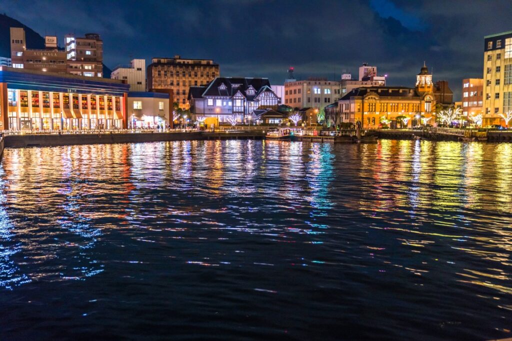
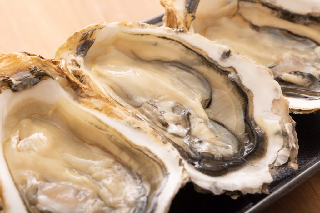
There are Karato Market in Shimonoseki and it is good idea to have fresh seafood breakfast there.
Day 4 Shimonoseki – Hiroshima
Start: Shimonoseki (下関)
Finish: Hiroshima (広島)
Mileage:220km
Travel Pace: Fast
On this day, you’ll travel from Shimonoseki to Hiroshima via the Kintaikyo Bridge and Miyajima Island’s world-famous Itsukushima Shrine.
Miyajima offers not only Itsukushima Shrine but also many other sights, such as Mt. Misen. Please use the following as a guide for the time required.
| 3 hours | Ferry, Shrine & lunch |
| 4 hours | Ferry, Shrine, M.Misen Ropeway & lunch |
| 5.5 hours | Ferry, Shrine, Mt.Misen Ropeway, Climbing & lunch |
Because of long drives and too many attractions, the travel pace is very fast. If you would like to travel at a relaxing pace, please consider staying in Hiroshima a few more nights and visiting Miyajima the next day.
Recommended Itinerary
1
Inn in Shimonoseki or Moji
Parking MAPCODE:
8:00
It is a little tough, but it is recommended you get up as early as possible to ensure you have enough time for sightseeing.
If you like seafood, it is a good idea to have breakfast not at the hotel but at Karato Market. They open at 6:00 a.m. on weekdays and Saturdays, 8:00 a.m. on Sundays, and PH. Please check the Driving Map for a MAPCODE.
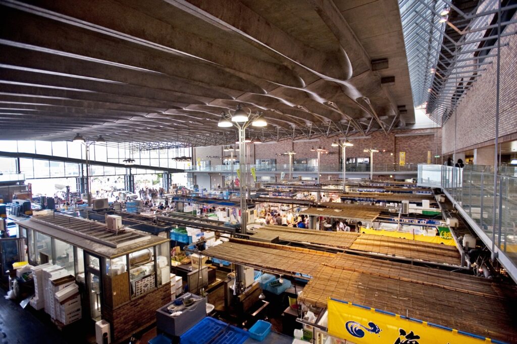
Karato Market & Kamon Wharf
115min
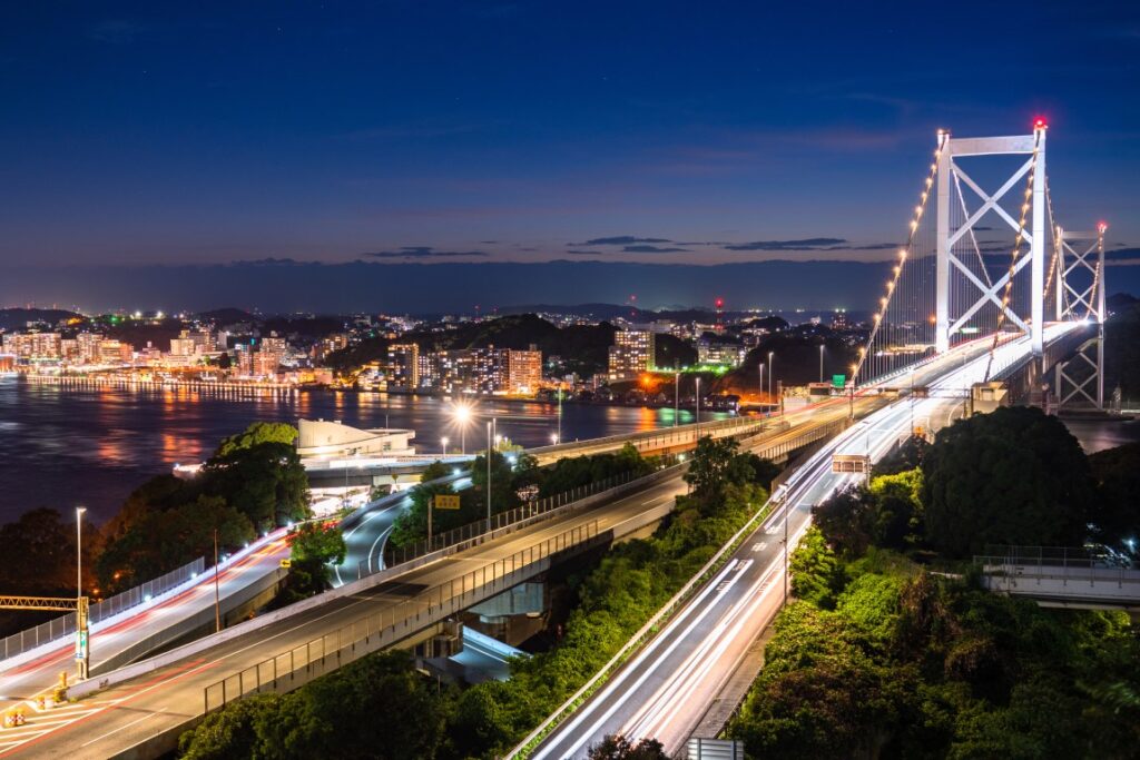
It is about 160km from Shimonoseki to Kintaikyo bridge. Therefore, please drive the expressway (E2).
Due to long drive on the expressway, plate take rest at “Service Area(SA)” along the expressway. “Sabagawa SA(佐波川SA)” is recommended.
2
Kintaikyo Bridge
Parking MAPCODE:
115 891 532*56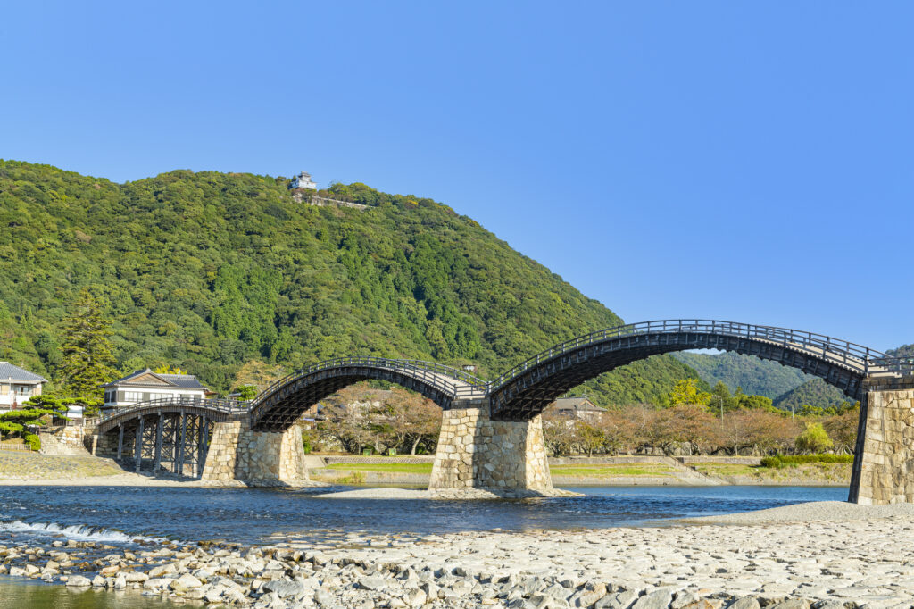
12:00
Then you will head to Kintaikyo Bridge, one of the three famous bridges in Japan. This bridge has five arches and is a rare wooden arch bridge in the world where no nails are used.
Kintaikyo Bridge
45min
3
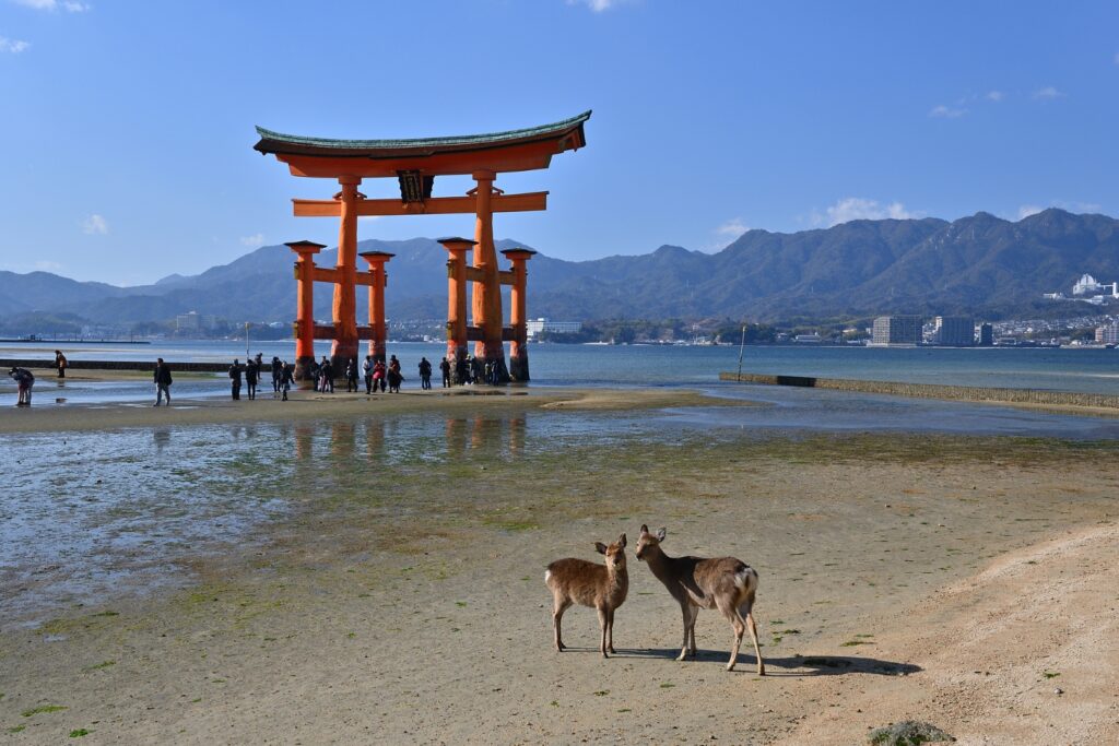
Itsukushima Shrine(Miyajima island)
Parking MAPCODE:
103 501 771*81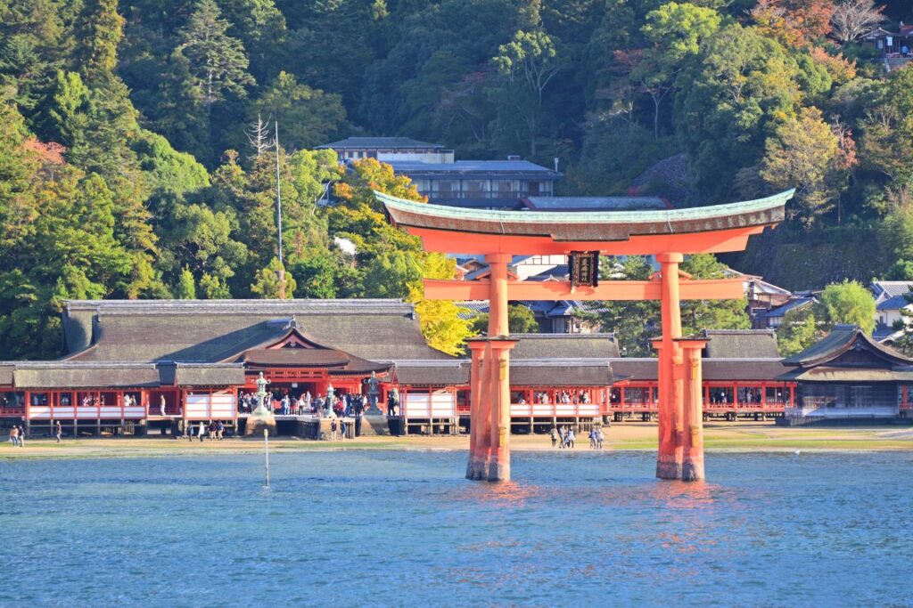
13:30
Miyajima Island, which is famous for its World Heritage Site, Itsukushima Shrine, is the highlight of this day. A vermilion-painted Otorii gate that juts out into the sea is famous as Japan’s icon.
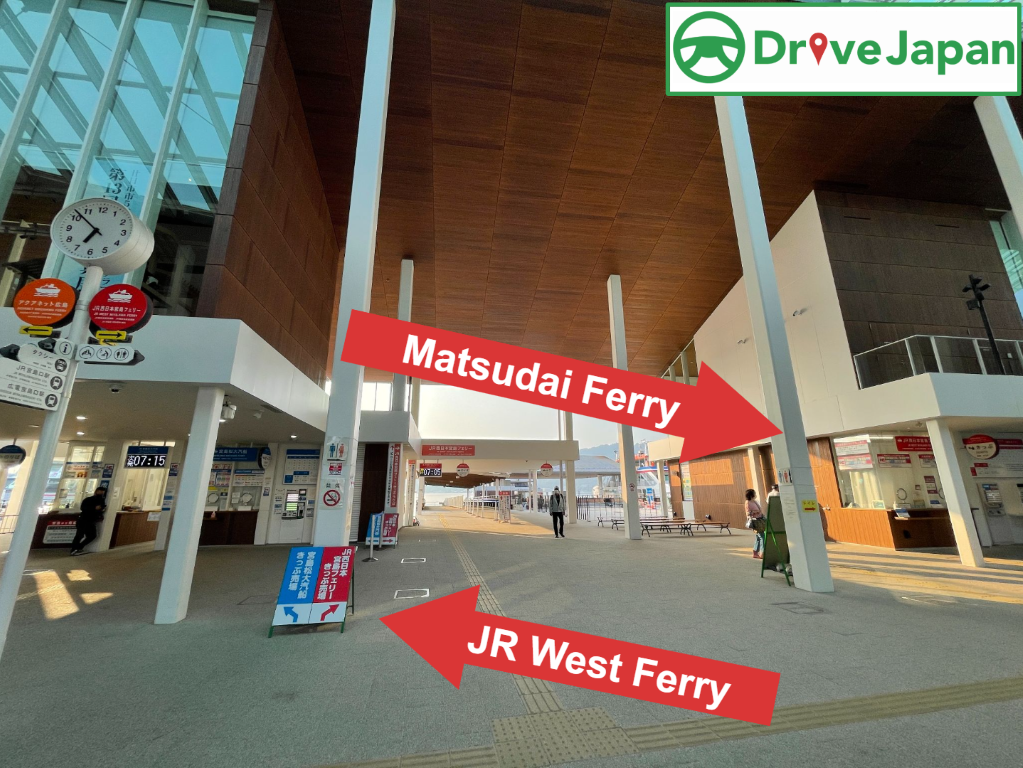
You need to take a ferry to the island. There are many parking lots at the ferry terminal, but the parking lot indicated by the MAPCODE is recommended.
There are two ferries, the JR West Ferry and the Matsudai Ferry. Both of them are almost the same, but if you want to visit Mt. Misen, Matsudai ferry and ropeway combination tickets are recommended.
| JR West Ferry | Matsudai Ferry | |
| Round Trip Fare | Adult JPY360 Child JPY180 | Adult JPY360 Child JPY180 |
| Cruise time | 10min | 10min |
| First departure | 6:25 | 7:15 |
| Feature | Ferry after 9:00 pass by the Torii Gate | JPY1800 for Ferry & Ropeway combination tickets |
Around the shrine, there are many attractions such as Senjokaku (Toyokuni Shrine) and Omotesando Shopping Street.

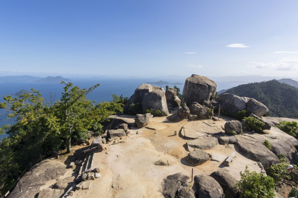
Another highlight of Miyajima is climbing Mt. Misen. At the top of the mountain, there are many natural giant rocks and unusual stones. You can also enjoy the view of Itsukushima Shrine and the Seto Inland Sea from the 360-degree panoramic observatory.
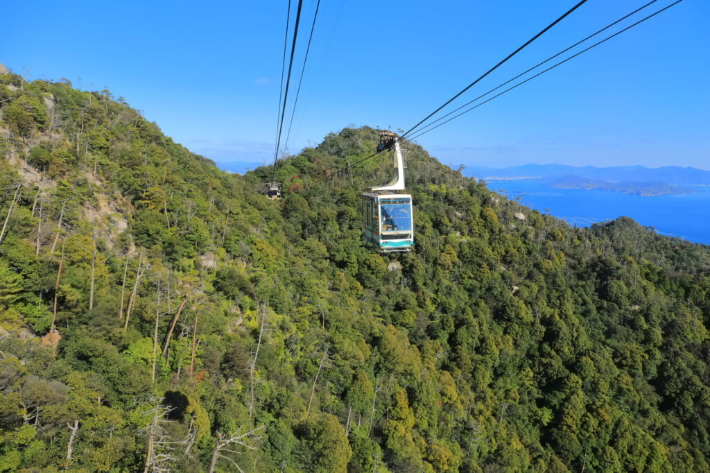
Miyajima is also a famous spot for autumn leaves in the Chugoku region. Miyajima Momijidani Park, a 5-minute walk from Itsukushima Shrine, is located at the foot of the Misen Primitive Forest, and during the season (end of October–end of November), about 700 autumn leaves color the park.
Google Town Map for Miyajima island
Itsukushima Shrine(Miyajima Ferry)
60min
Driving Map For the Day
The driving map will show an additional 10-20 spots for the day. You will travel only to your favorite spots. Click the pin on the map and input the parking MAPCODE into your car navigation system (GPS). It will guide you to the nearest parking lot for each spot!
Where to stay in Hiroshima
Hiroshima is the biggest city in the Chugoku&Shikoku area.
There are many hotels between Hiroshima Station and Peace Park. The “Hatchobori(八丁堀)” and “Nagarekawa(流川)” areas on the east side of Peace Park are downtown areas of Hiroshima, and restaurants are concentrated here. It is convenient to book a hotel within walking distance of Peace Park and the Atomic Bomb Dome.
- Inn Type
Most of these inns are various western-style hotels. - Parking
Some inns have official parking but in addition to the accommodation fee, the parking lot fee will be charged separately. - Meal Plan Reservations
As many restaurants are open till midnight, it is recommended to book your inns with breakfast only or without meals.
Day 5 Hiroshima – Hiroshima Airport
Start: Hiroshima (広島)
Finish: Hiroshima Airport (広島空港)
Mileage:50km
Travel Pace: Relax
On this day, you will be returning from Hiroshima to Hiroshima Airport.
Recommended Itinerary
1
Inn in Hiroshima
2
Hiroshima Atomic Bomb Dome&Peace Memorial Park
Parking MAPCODE:
22 189 461*58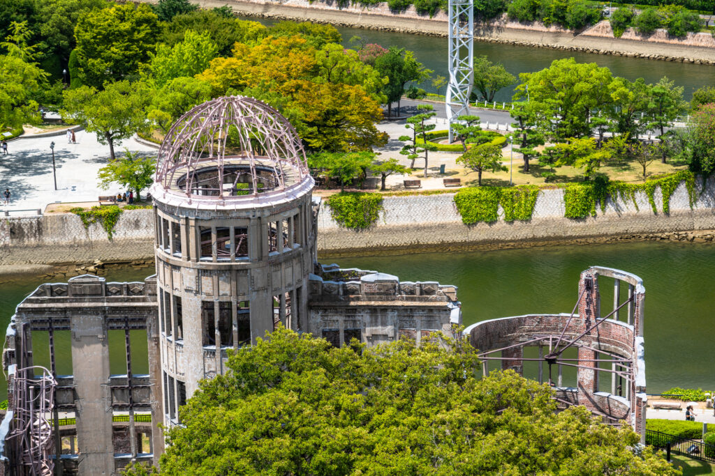
9:15
If you haven’t been to [the Atomic Bomb Dome and Peace Memorial Park] yet, be sure to visit.
It takes about 30 minutes to walk around the Atomic Bomb Dome and Peace Park, and at least an hour for the museum.
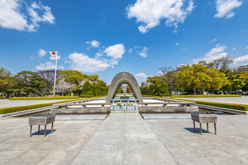
Atomic bomb dome & Peace Park map
60 min
Hiroshima Airport is located 50 kilometers away from Hiroshima city.
It is recommended to take the expressway (E2) to the airport.
3
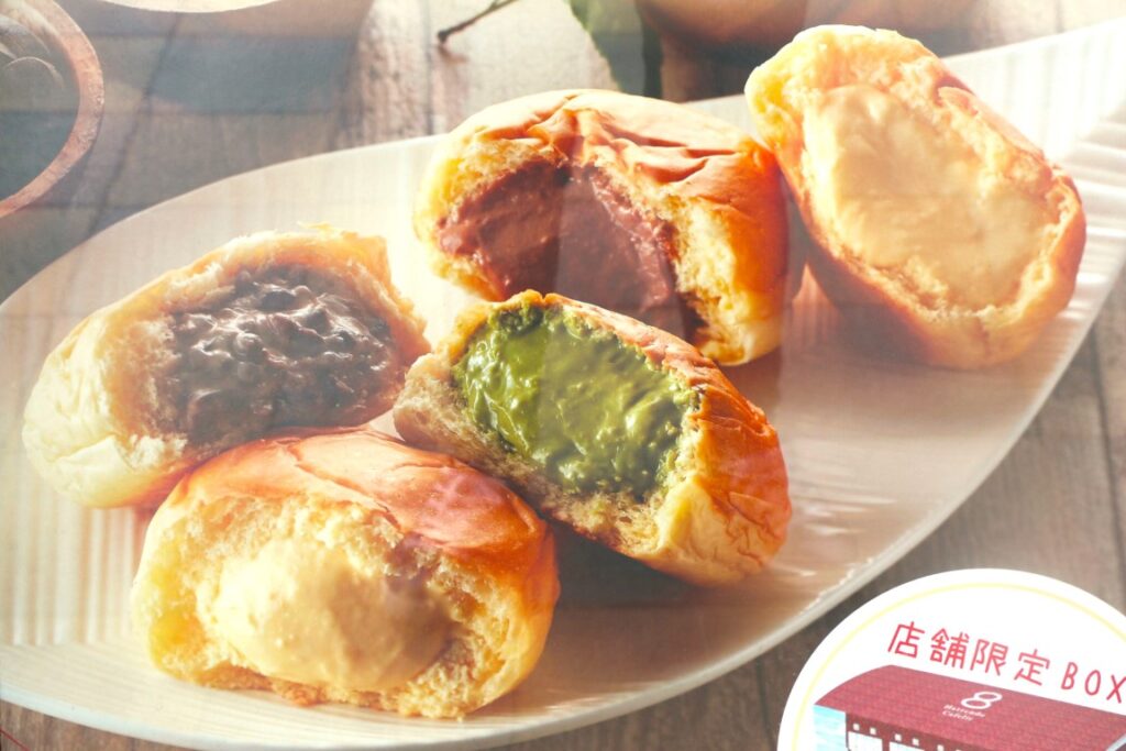
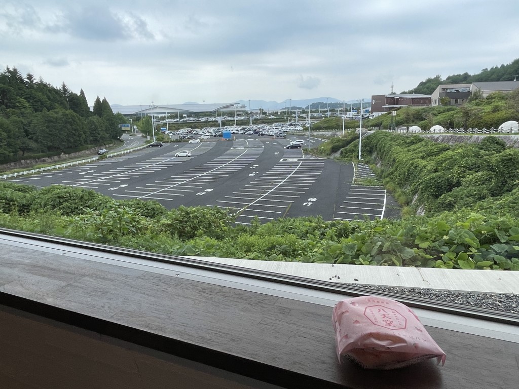
Hattendo Village
Parking MAPCODE:
257 095 02012:00
If you have time before your flight, Hattendo Village, located next to the airport, is nice to stop by.
A famous bakery that sells cream-filled rolls
Here are many attractions such as miniature ponies, athletic playground equipment, and photo spots.
Driving Map For the Day
The driving map will show an additional 10-20 spots for the day. You will travel only to your favorite spots. Click the pin on the map and input the parking MAPCODE into your car navigation system (GPS). It will guide you to the nearest parking lot for each spot!