
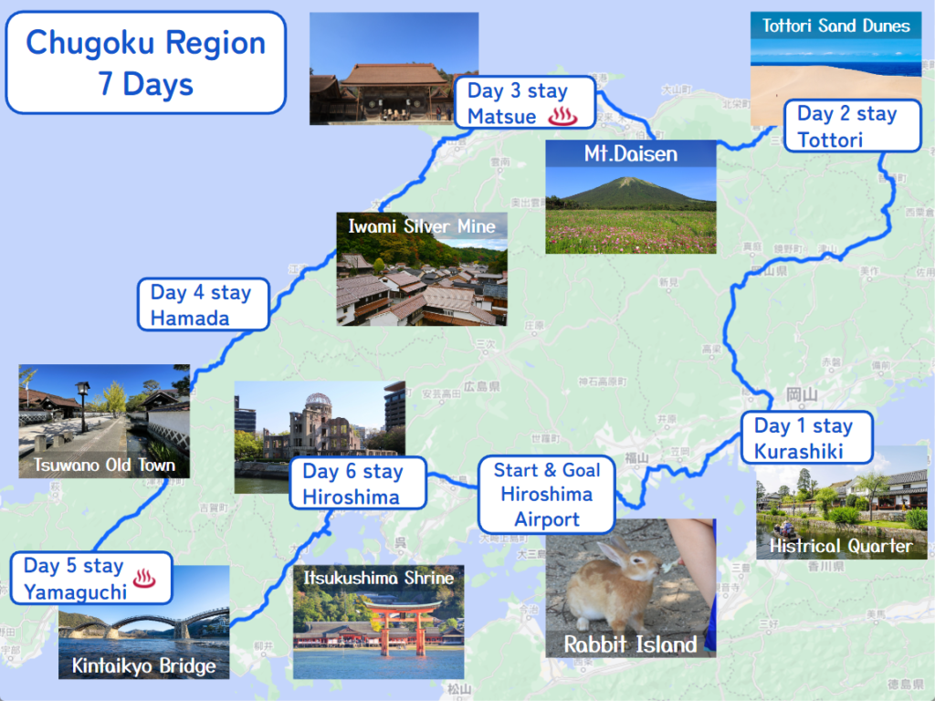
Summary
- Start
Hiroshima airport - Finish
Hiroshima airport - Mileage
Total 960km
140km per day - Travel Pace
Fast - Onsen Stay
At least 2 nights - Expressway Fee
About JPY6,000
You can travel the whole San’in Sanyo area in 7 days with this itinerary.
You can visit the charming historical town of Kurashiki, Tsuwano, the vast Tottori Sand Dune, and 3 world heritage sites including Hiroshima atomic bomb dome.
Rental Car
Rental car from Hiroshima Airport
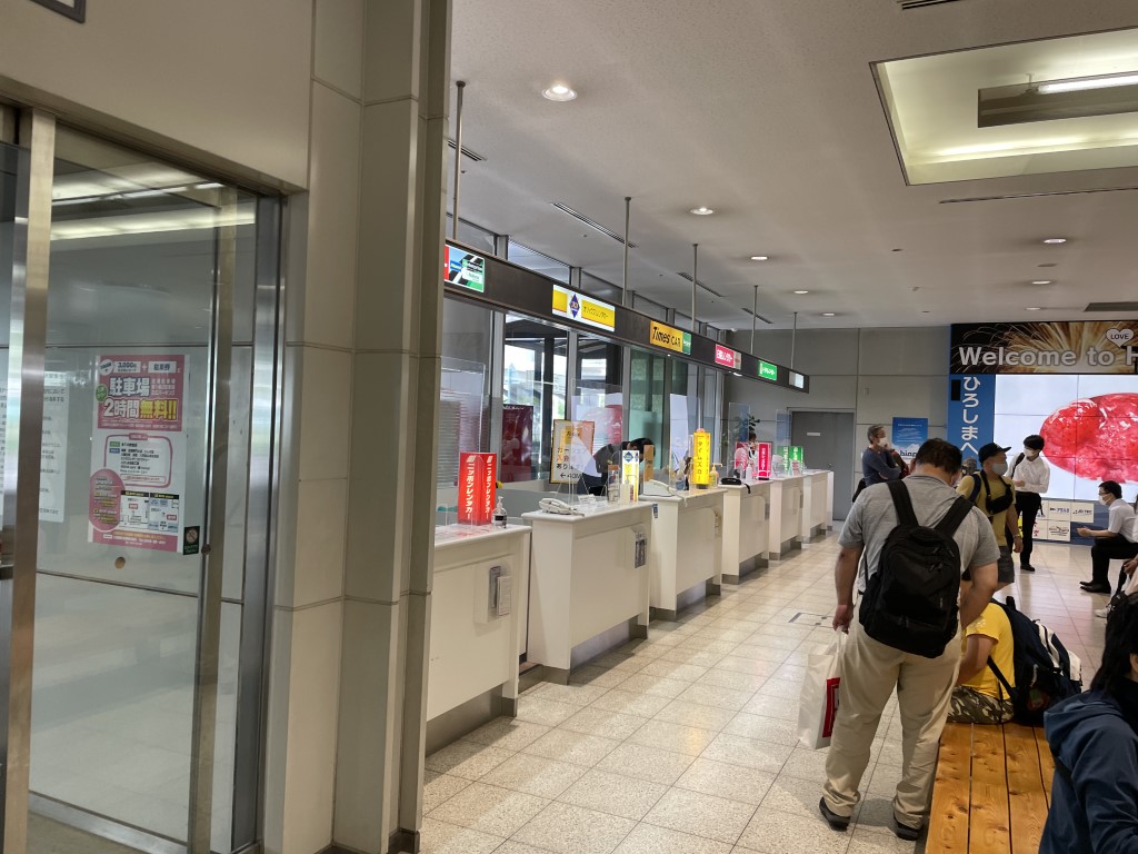
5 rental car companies operate at the Hiroshima airport.
All company counters are located in front of the arrival hall of domestic flights.
- Nippon Rent-a-Car
7:00-21:30 - Toyota Rent a Car
8:00-20:00 - Orix Rent-a-Car
8:00-20:00 - Nissan Rent a Car
8:00-20:00 - Times Car Rental
8:00-20:00
Day 1 Hiroshima Airport – Kurashiki
Start: Hiroshima Airport (広島空港)
Finish: Kurashiki (倉敷)
Mileage:140km
Travel Pace: Normal
On this day you are heading from Hiroshima Airport to Kurashiki, which is famous for its historical district.
Recommended Itinerary
1
Rental car branch at Hiroshima Airport
Parking MAPCODE:
9:00
Hiroshima
The airport is the gateway to Chugoku & Shikoku area. First of all, please complete the reception procedure at the rental car counter at the airport. It takes about 5 minutes by free shuttle bus to the rental car company branch.
The mileage of this day is about 140 km, so you can travel at a normal pace. If you can leave by about 14:00, you can go to Kurashiki while sightseeing at some spots. If your flights arrive late at night, please consider staying at a hotel near the airport.
45 min
2
Senkoji Temple
Parking MAPCODE:
48 248 862*52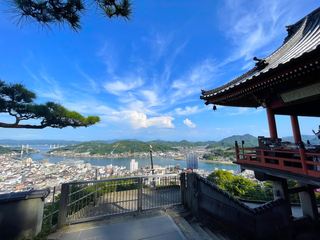
10:00
The next place to visit is [Senkoji Temple] in Onomichi City. Senkoji Temple is located on a hill at an altitude of 140 m, and from the precincts, you can see the city, Onomichi Port, and the Onomichi Channel where ships come and go.
50 min
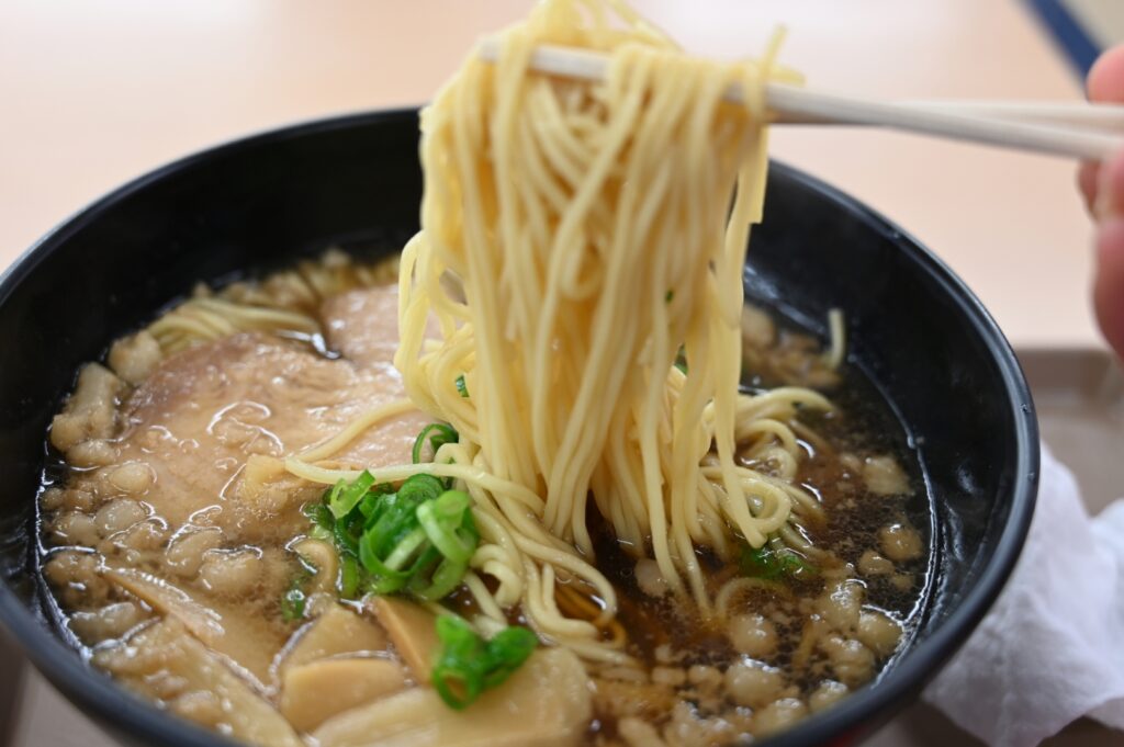
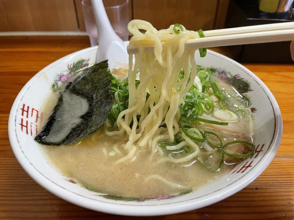
Onomichi ramen is recommended for lunch. The soy sauce ramen with chicken stock and dried sardines is delicious.
3
Tomonoura
Parking MAPCODE:
465 451 490*77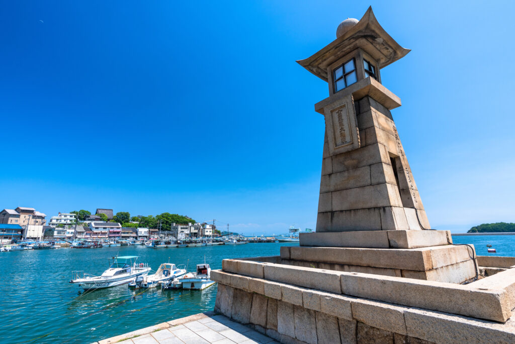
13:00
After leaving Senkoji Temple, head to Tomonoura, which is known as a location for various movies. It is one of the most scenic spots in the Seto Island Sea and is dotted with places related to Ryoma Sakamoto, a famous person in Japanese history.
In Tomonoura, please stop by [Homeishu Store] while enjoying a walk in a narrow alley. Beginning with the medicinal liquor made by soaking 16 kinds of herbs, the unique flavor becomes addictive.
70 min
Your last visit on this day was [Kurasaki Bikan Historical Quarter]. It takes about 1 hour and 10 minutes to drive on the expressway (E2).
Kurashiki is a place to enjoy walking around town, so it is recommended to check into your inn first!
4
Inn in Kurashiki
Parking MAPCODE:
Please head to the hotel you reserved.15:15
You will stay in Kurashiki on this day.
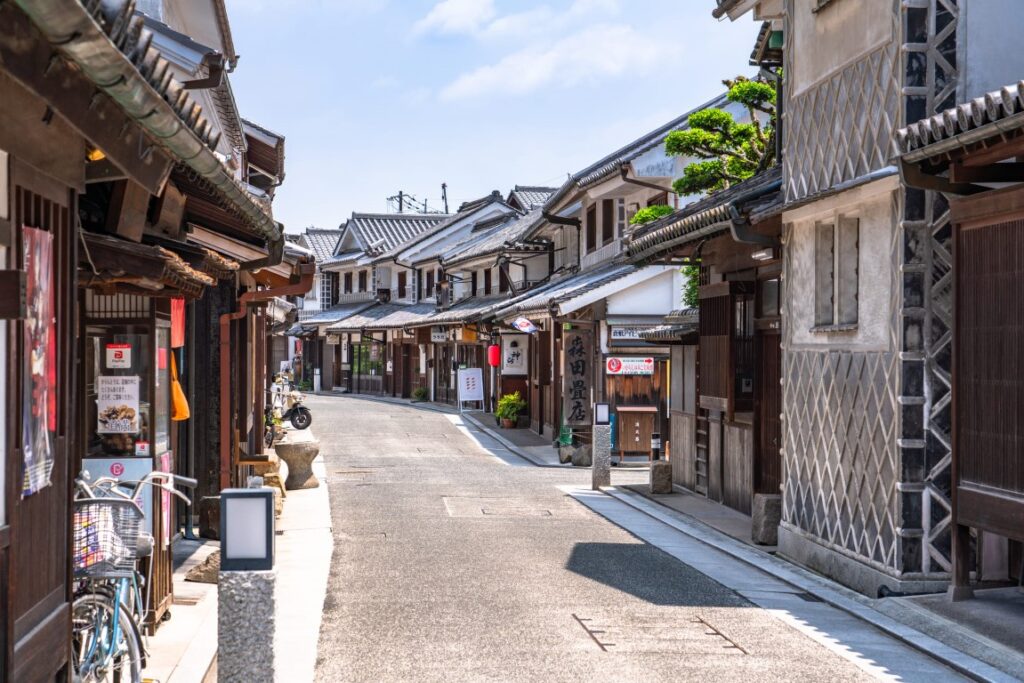
In Kurashiki, hotels are concentrated between Kurashiki Station and the Bikan Historical Quarter, but it is recommended to stay as close to the Historical Quarter as possible. Enjoy a fantastic night walk in the Kurashiki Bikan Historical Quarter.
walking
5
Kurashiki Bikan Historical Quarter
Parking MAPCODE:
Walk from your inn or 19 632 049*68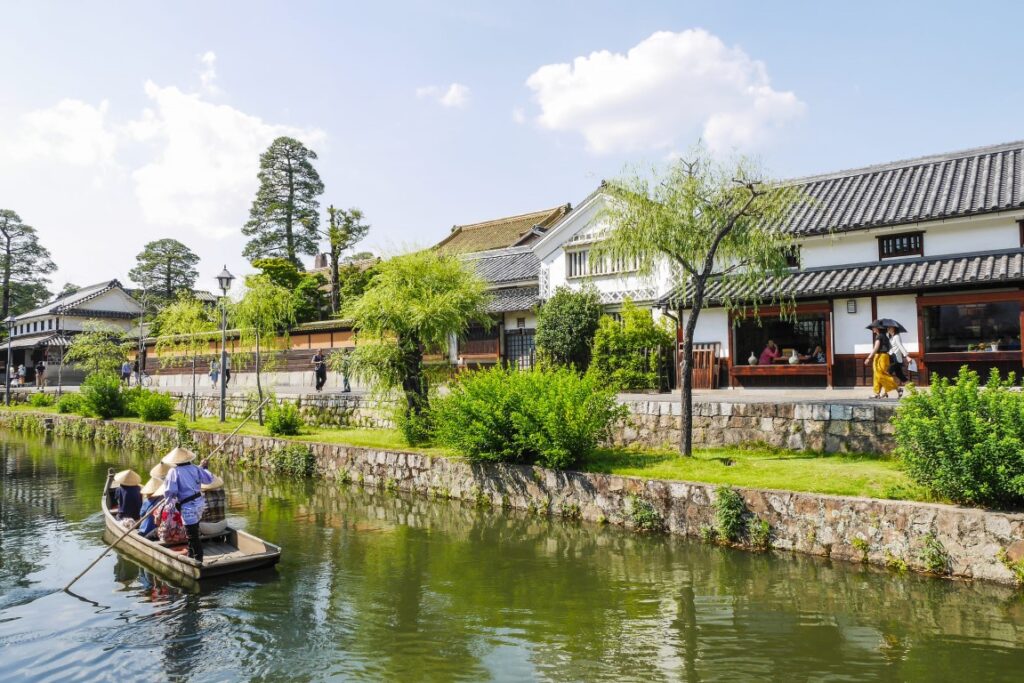
Your last visit on this day was [Kurashiki Bikan Historical Quarter].
Traditional white-walled buildings, a quaint Kurashiki River, willows, and bridges harmonize beautifully, leaving the beauty of a good old Japanese town and making you want to walk for hours. In addition, it is a town full of various attractions, such as the Ohara Museum of Art.
The Kurashiki Bikan Historical Quarter is an overwhelmingly spectacular place among the many old townscapes in Japan. However, many shops close around 17:00, so if you want to spend more time in Kurashiki, make sure to arrive by around 14:00.

There are also [Roadside Station Kasaoka Bay Farm] along the day’s route.
Normally roadside stalls are rest spots for drivers, but this one is really famous for its amazing flower gardens.
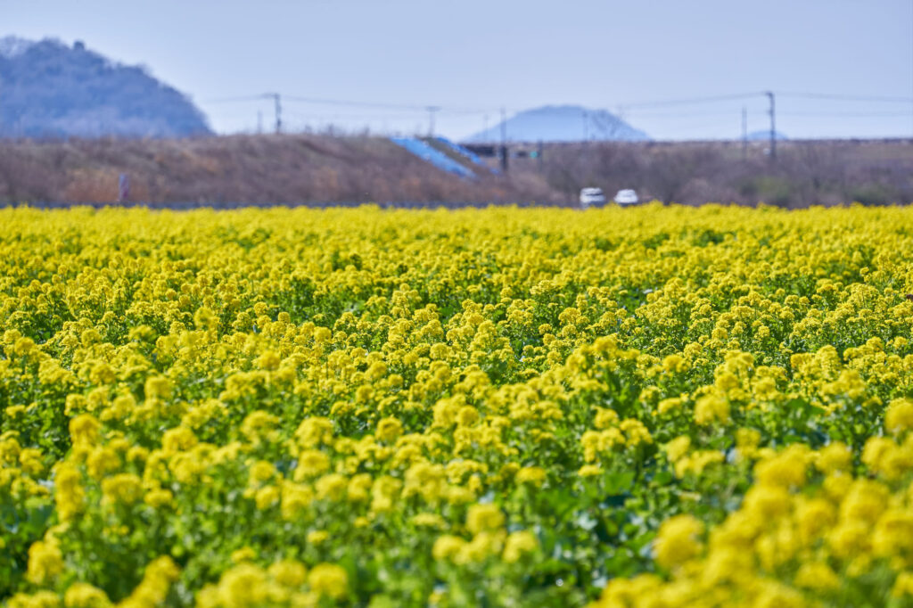
It is one of the best observatories in the Chugoku and Shikoku regions.
Driving Map For the Day
The driving map will show an additional 10-20 spots for the day. You will travel only to your favorite spots. Click the pin on the map and input the parking MAPCODE into your car navigation system (GPS). It will guide you to the nearest parking lot for each spot!
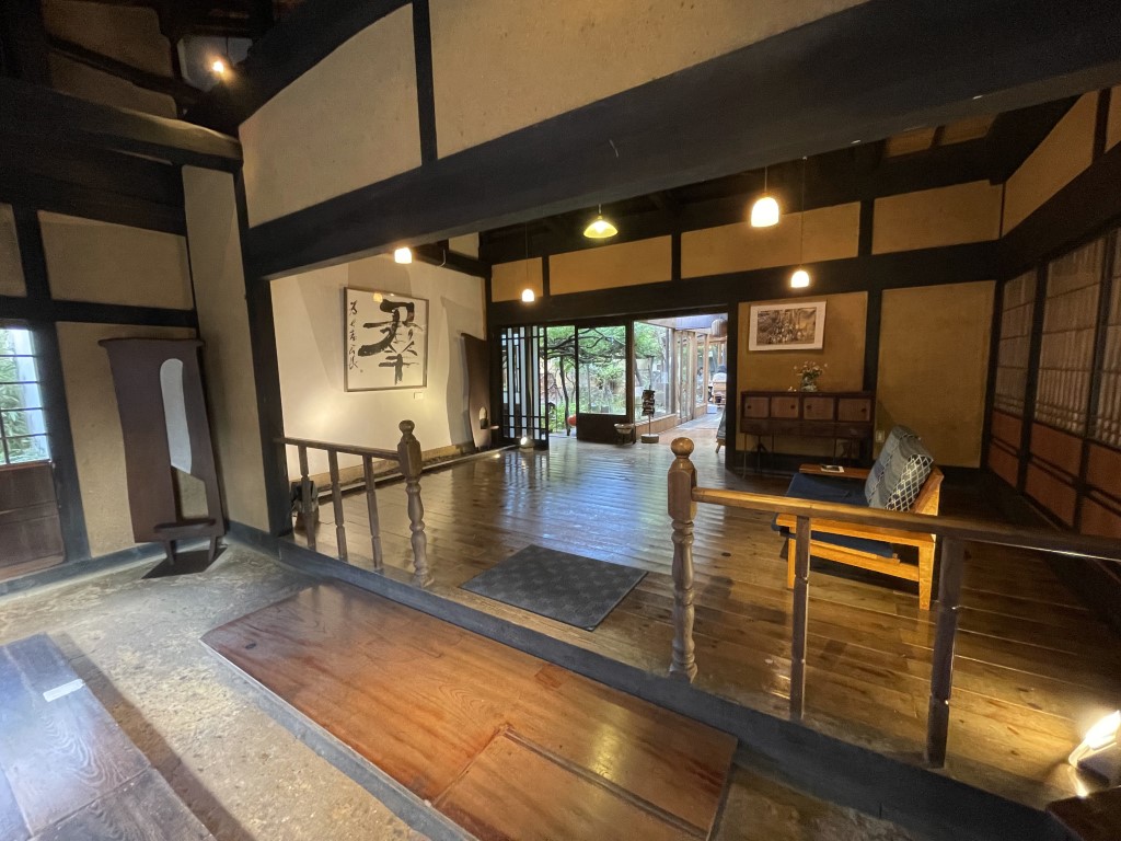
Where to stay in Kurashiki
On this day, you will stay in Kurashiki(倉敷) City which is famous for its old townscape.
Many inns are concentrated between Kurashiki station and the “Bikan Historical Quarter” area.
- Inn Type
There are a variety of inns like western-style hotels and Japanese Ryokans. Please book at your preferred type of inn. - Parking
Most inns have official parking but in addition to the accommodation fee, the parking lot fee will be charged separately. - Meal Plan Reservations
As many restaurants are open till midnight, it is recommended to book your inns with breakfast only or without meals.
Day 2 Kurashiki – Tottori
Start: Kurashiki (倉敷)
Finish: Tottori (鳥取)
Mileage:170km
Travel Pace: Fast
On this day you will head from Kurashiki to Tottori.
Recommended Itinerary
1
Inn in Kurashiki
It is far from Kurashiki to the next spot. Please take the expressway (E73).
2
Fukiya Old Village
Parking MAPCODE:
236 371 883*28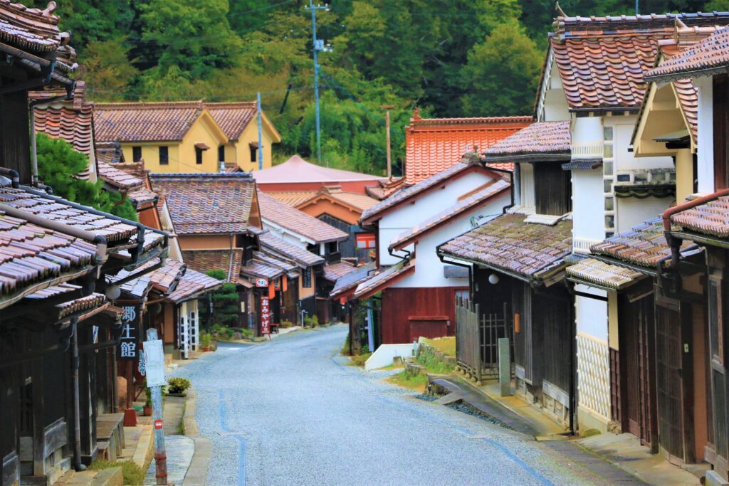
10:40
Fukiya was the first town in Japan to succeed in producing Bengala (Red Iron Oxide, which is one of the red pigments and abrasives), and it prospered as the major production center in Japan. Walking through the street is almost like going back in time as many of the houses have been beautifully preserved.
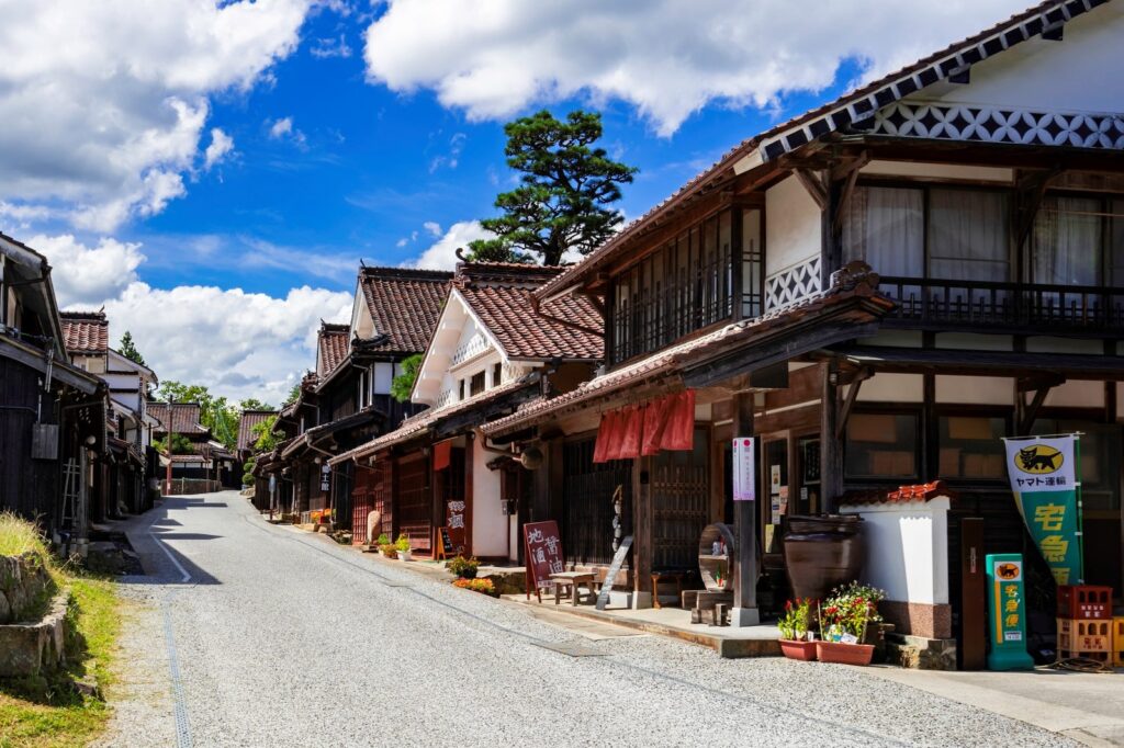
Fukiya Old Village
35min
3
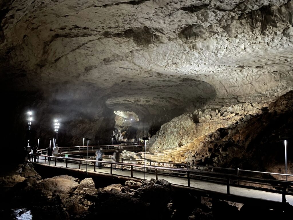
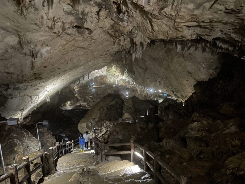
Ikurado Cave
Parking MAPCODE:
236 618 720*37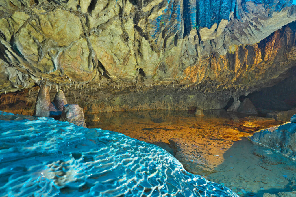
12:15
The next spot is Ikurado Cave. It is a limestone cave with a total length of 1200 m, and there is a big waterfall that is 50 m inside. Make sure you have shoes that can grip on wet stones or pavement.
Ikura Cave
60min
4
Roadside Staiton Kumenosato
Parking MAPCODE:
153 486 272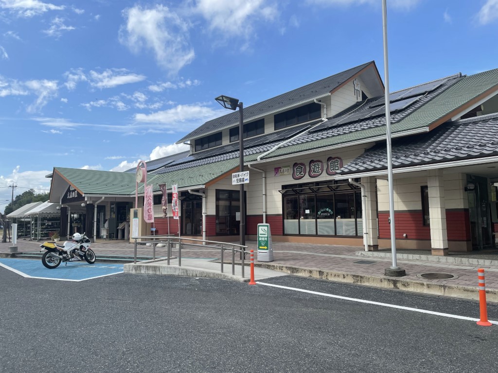
14:15
You are about halfway through today’s itinerary. If you feel tired, why don’t you stop at a roadside station? It is called “Michinoeki” in Japanese and there are restaurants, shops with many local products, and toilets.
60min
5
Ishitani Residence
Parking MAPCODE:
390 643 724*71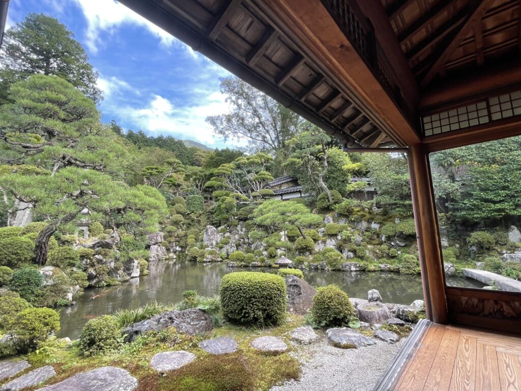
15:30 (the last entry is 16:30)
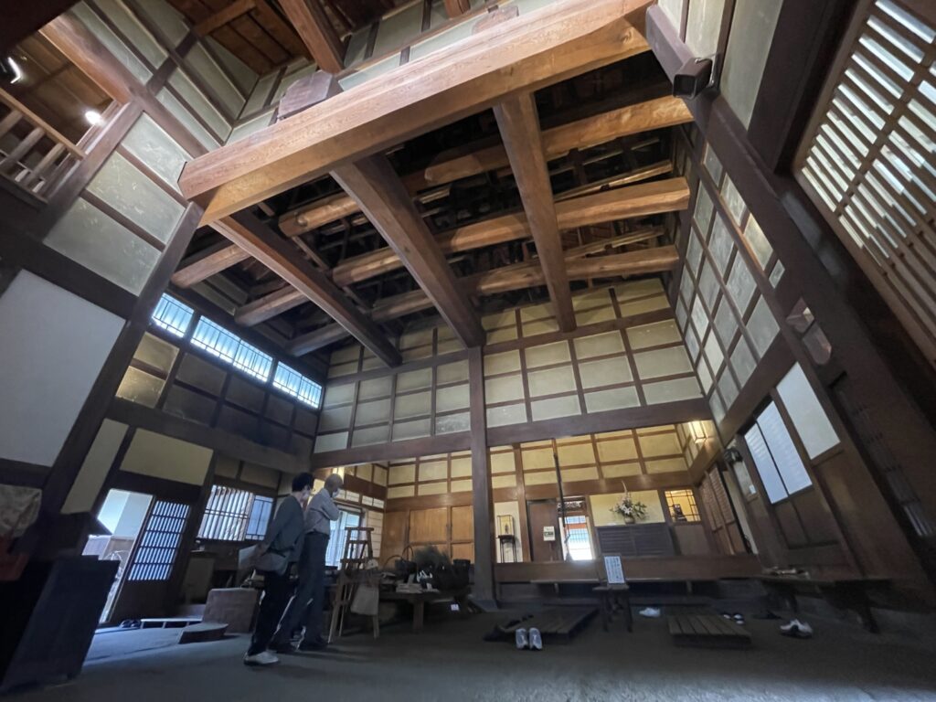
Before you reach Tottori, there is Ishitani Residence.
This old residence was owned by the same family for generations. The gardens are impeccably kept by a third-generation gardener.
Ishitani Residence
45min
6
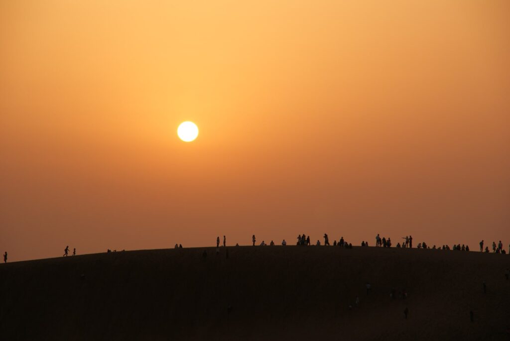
Tottori Sand Dune
7
Inn in Tottori
Parking MAPCODE:
Please head to the hotel you reserved.On this day you will stay in Tottori. Many restaurants open till night.
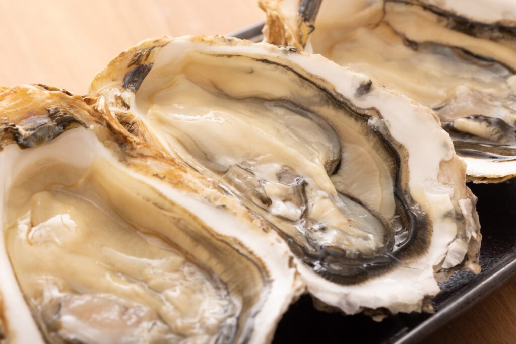
Tottori’s specialty is oyster summer and snow crab in winter.
It is recommended to book your hotel without dinner and try local restaurants around your inn.

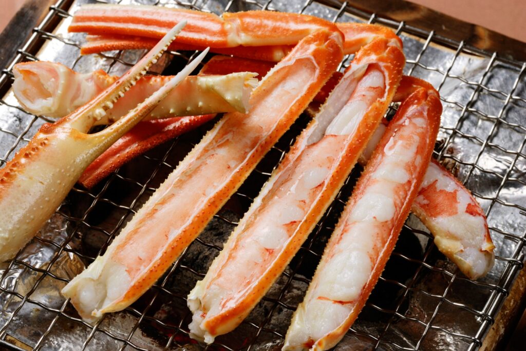
Grilled snow crab
Driving Map For the Day
The driving map will show an additional 10-20 spots for the day. You will travel only to your favorite spots. Click the pin on the map and input the parking MAPCODE into your car navigation system (GPS). It will guide you to the nearest parking lot for each spot!
Where to stay in Tottori
On this day, you will stay in Tottori (鳥取) city.
Many inns are concentrated north side of Tottori Station.
- Inn Type
Most of these inns are reasonable western-style hotels. - Parking
Most inns will offer free parking. - Meal Plan Reservations
As many restaurants are open till midnight, it is recommended to book your inns with breakfast only or without meals.
Day 3 Tottori – Matsue
Start:Tottorie (鳥取)
Finish:Matsue (松江)
Mileage:150km
Travel Pace:Normal
On this day, you will head to Matsue from Tottori via Daisen.
Recommended Itinerary
1
Inn in Tottori
2
Kurayoshi Shirakabe Storehouses town
Parking MAPCODE:
189 654 338*57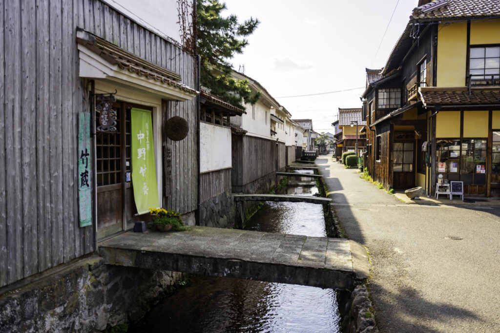
10:00
If you drive for about an hour from Tottori, you will find [Kurayoshi Shirakabe Storehouses Town]. You can enjoy a walk in the nice atmosphere of the old storehouses. Lunch here is also a good idea as there are many restaurants.
Kurayoshi Town Map
5 min
3
Tottori Nijisseiki Pear Museum
Parking MAPCODE:
189 655 283*11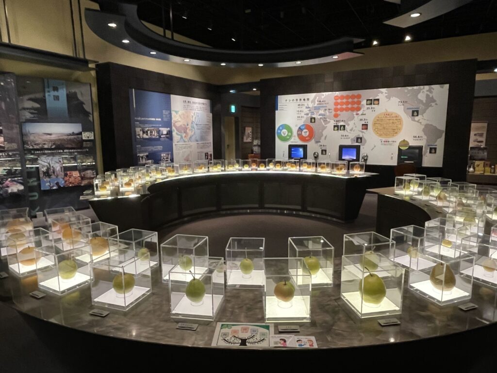
12:00
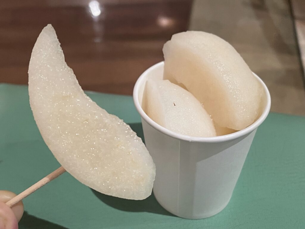
Tottori is famous for the production of high-quality pears. At this museum, you can learn and eat very delicious pears.
Tottori Nijisseiki Pear Museum
60min
Kurayoshi town is famous for its “Gyukotsu Ramen” and is a recommended spot for lunch.
4
Kagikake Pass Observatory
Parking MAPCODE:
252 351 127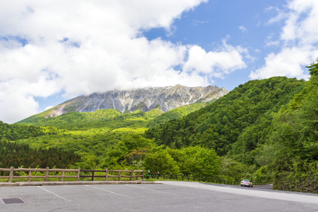
13:30
You will then head towards Daisen. [Kagikake Pass Observatory] is the most recommended observatory in Daisen. The autumn leaves in particular are wonderful. We recommend that you visit there.
45 min
5
Adachi Museum of Art
Parking MAPCODE:
109 158 324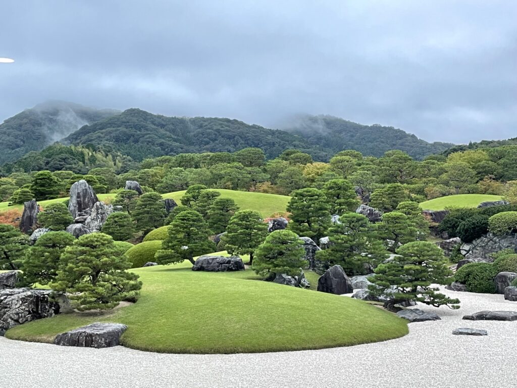
15:00
The most recommended site of the day is [Adachi Museum of Art]. It has been selected as No. 1 in the American Japanese garden magazine since 2003, and its beauty is superb. This is a must-see even for those who are not interested in gardens.
The collection of Taikan Yokoyama, a major Japanese painter, is also worth seeing.
40 min
6
Lake Shinji
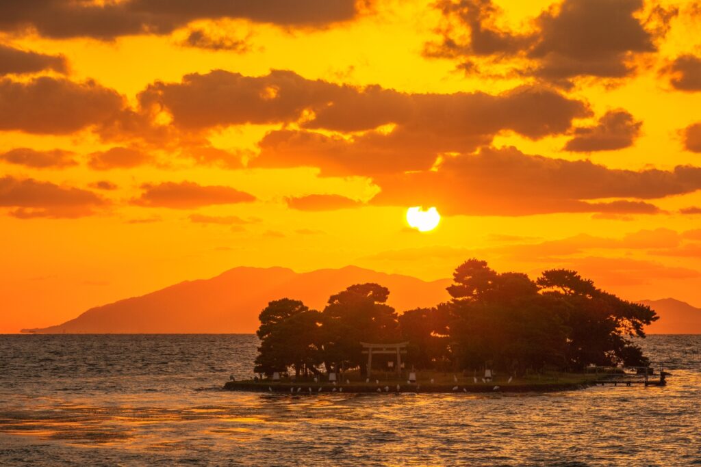
7
Inn in Matsue

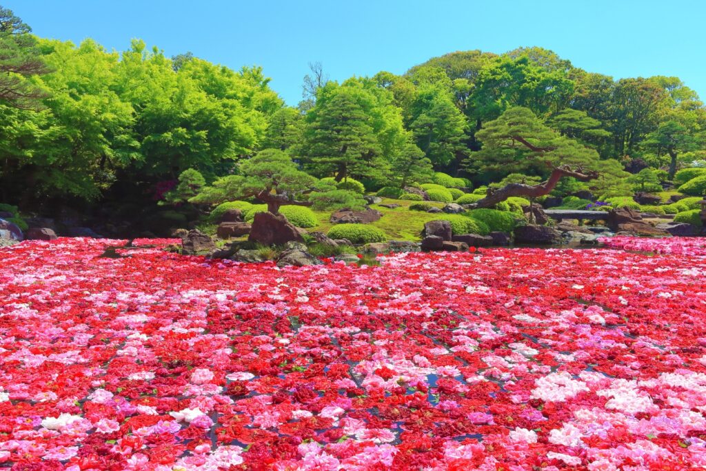
If you travel during Golden Week (long holiday period from end of April to beginning of May), you must visit [Yushien Garden]! Their Chisen Botan (Japanese peony) is overwhelmingly beautiful.
Driving Map For the Day
The driving map will show an additional 10-20 spots for the day. You will travel only to your favorite spots. Click the pin on the map and input the parking MAPCODE into your car navigation system (GPS). It will guide you to the nearest parking lot for each spot!
Where to stay in Matsue
On this day, you will stay in Matsue city.
You can choose the following two areas.
①Matsue city
Accommodations are concentrated around Matsue Station and on the north side of the Ohashi River, but the north side of the Ohashi River is more convenient for dinner.
It is also convenient for visiting Matsue castle but no inns offer Onsen.
- Inn Type
Most of these inns are reasonable western-style hotels. - Parking
Most inns have official parking but in addition to the accommodation fee, the parking lot fee will be charged separately. - Meal Plan Reservations
As many restaurants are open till midnight, it is recommended to book your inns with breakfast only or without meals.
②Tamatsukuri Onsen(玉造温泉)
This hot spring resort area is located 6km southwest of Matsue. If you would like to stay in better accommodation with Onsen, here is recommended.
- Inn Type
Most of these inns are various Japanese-style Ryokans with Onsen facilities. - Parking
Most inns will offer free parking. - Onsen
Tamatsukuri Onsen is very famous for its skin beautifying effects and is very popular among female travelers. - Meal Plan Reservations
There are few restaurants in this area and be sure to make a reservation with a plan that includes dinner and breakfast.
Day 4 Matsue – Hamada
Start: Matsue (松江)
Finish: Hamada (浜田)
Mileage:150km
Travel Pace: Fast
On this day you will head from Matsue to Hamada.
Recommended Itinerary
1
Inn in Matsue
Parking MAPCODE:
9:00
The mileage is about 150 km, and it is a day with many spectacular sightseeing spots such as Matsue Castle, Izumo Grand Shrine, and Iwami Ginzan Silver Mine Village.
Iwami Ginzan Silver Mine Village, in particular, can be time-consuming, so an early morning departure is strongly advised.
5 min
2
Matsue Castle
Parking MAPCODE:
163 501 408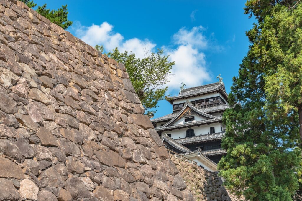
9:10
First thing in the morning, go to Matsue Castle, the symbol of Matsue. It is a wonderful castle known as the original castle tower.
Matsue Castle
60 min
3
Izumo Grand Shrine
Parking MAPCODE:
258 832 552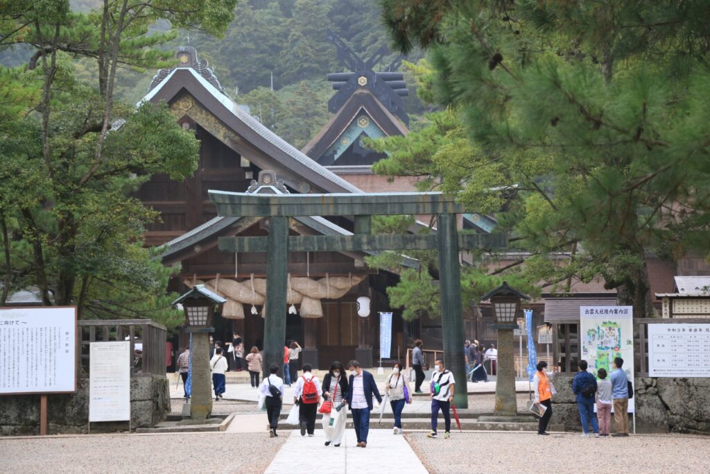
11:10
It takes about an hour from Matsue to arrive at the Izumo Grand Shrine].
Along with Ise Jingu, it is the most important shrine in Japan. This is the biggest attraction in the Sanin Region and is an overwhelming sight.
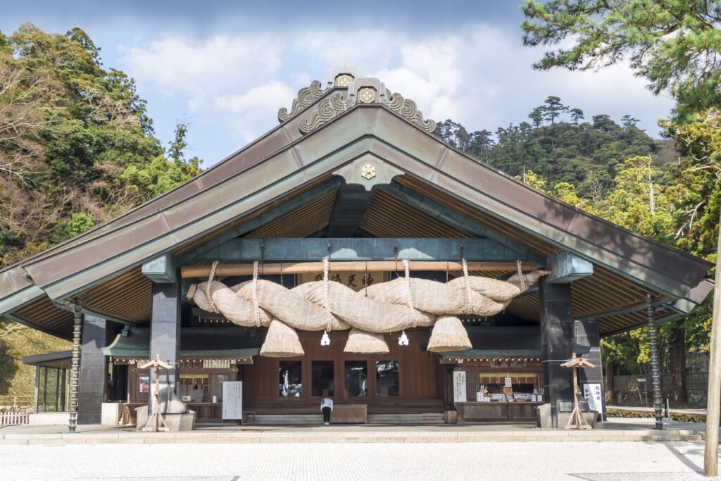
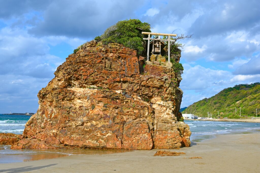
Inasa Beach, only 1 km west of the shrine, is also worth a visit.
Izumo Grand Shrine
60 min
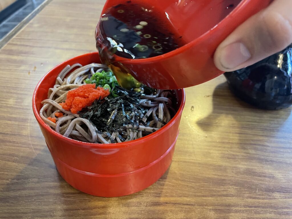
Speaking of Izumo lunch, Izumo soba is definitely recommended. It is characterized by being black because the buckwheat fruit is ground in a stone mill together with the skin.
4
Iwami Ginzan Silver Mine village
Parking MAPCODE:
Please refer below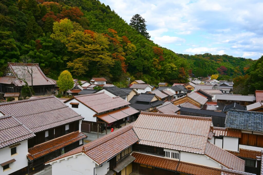
14:15
If you drive from Izumo on the expressway (E9) for about 50 km for about 1 hour, you will reach the World Heritage Site [Iwami Ginzan Silver Mine Village].
The following parking lots are recommended:
①2nd Free Parking
MAPCODE: 599 144 182*37
②1st Free Parking
MAPCODE: 599 113 262*56
Please refer Google town map below.
Please refer Google town map below.
The process of refining silver requires large quantities of timber. In spite of this Iwami Ginzan Silber Mine is considered a “Suitable Industrial Historic site”, as it kept the environment in consideration during the production of silver.
(You need to walk 4 kilometers from the parking lot to the mine shaft)
The town of Omori at the foot of the mountain is worth seeing. You can enjoy a stroll through the mansion with its hidden storehouse used for silver trading and the wonderful townscape. We also recommend lunch at a cafe that has been renovated from an old farmhouse.
Google Town map for Iwami Ginzan Silver Mine village
Iwami Ginzan Silver Mine village
90min
From Silver Mine village to Hamada town, there are not many spots to see.
Driving Map For the Day
The driving map will show an additional 10-20 spots for the day. You will travel only to your favorite spots. Click the pin on the map and input the parking MAPCODE into your car navigation system (GPS). It will guide you to the nearest parking lot for each spot!
Where to stay in Hamada
Hamada is not very big city. The inns are concentrated south side of Hamada station.
- Inn Type
Most of these inns are reasonable western-style hotels. - Parking
Some inns have official parking but in addition to the accommodation fee, the parking lot fee will be charged separately. - Meal Plan Reservations
Some restaurants are open till midnight. You can also book with dinner and breakfast.
Day 5 Hamada – Yamaguchi
Start: Hamada (浜田)
Finish: Yamaguchi (山口)
Mileage:130km
Travel Pace: Relax
On this day you will head from Hagi to Yamaguchi.
Recommended Itinerary
1
Inn in Hamada
Parking MAPCODE:
9:00
The mileage is about 130 km, and it is not a busy day.
However, if you would like to visit “Akiyoshidai Karst Observatory (秋吉台カルスト展望台)” and “Akiyoshido Limestone Cave (秋芳洞),” it is hard and highly recommended to depart before 8:00.
60min
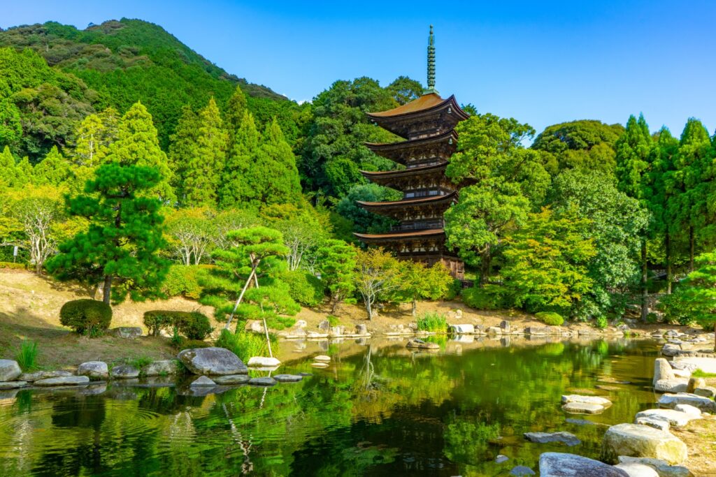
2
Sesshu’s gardens and museum
Parking MAPCODE:
277 343 014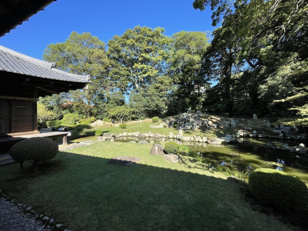
10:00
The first destination of the day is a Japanese garden.
Sesshu (1420–1502) was a Buddhist monk who is famous for painting and gardens. And there are three gardens and his museum.
The above mapcode is for Manpukuji Temple, and please refer to the map below for other gardens.
Map for 3 sesshu’s garden
Sesshu’s gardens and museum
50min
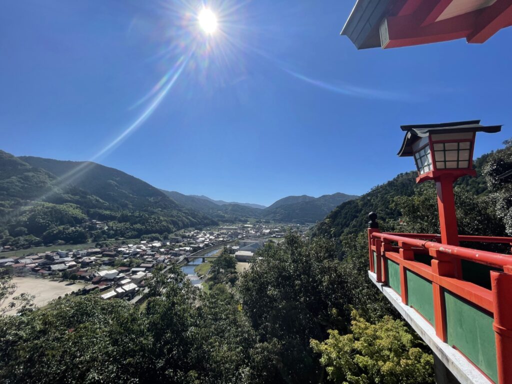
3
Tsuwano Old Town
Parking MAPCODE:
513 153 693*31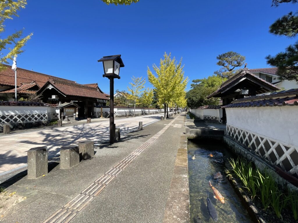
11:15
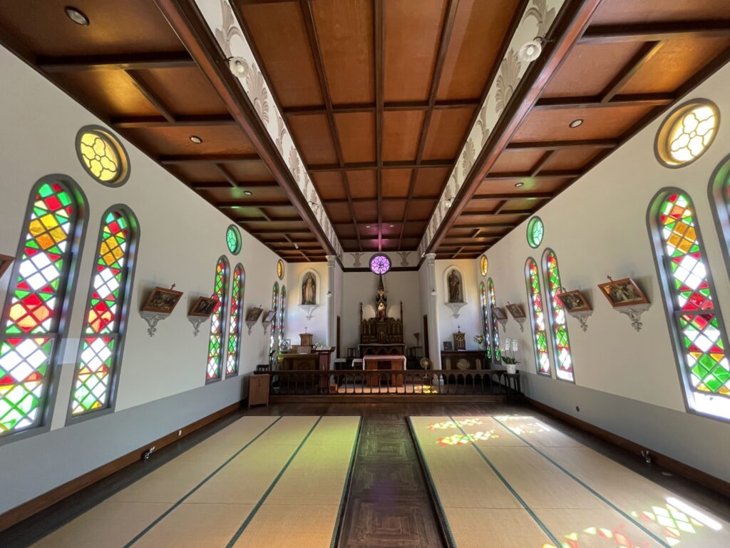
It is about 35 km to the next destination, “Tsuwano Old Town”. Tsuwano, the day’s highlight, is a very beautiful old town with a moat where carp swim. There are Japanese-style Catholic churches that are worth visiting.
Tsuwano Town Map
Tsuwano Old Town
5min
4
Taikodani Inari Shrine
Parking MAPCODE:
513 152 378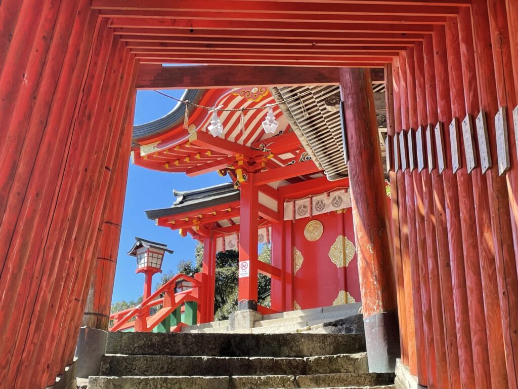
Another highlight of this day is “Taikodani Inari Shrine(太皷谷稲成神社)”. It is an undiscovered, very beautiful red shrine located on the hill, and you can look down on Tsuwano Town. The shrine also has a red torii gate tunnel with 263 steps. If you are fine walking, it is a great experience to walk from Tsuwano town to the shrine and to try to climb it.
Taikodani Inari Shrine
45min
4
Roadside Station Chomonkyo Gorge
5
Rurikoji Temple
6
Inn in Yamaguchi
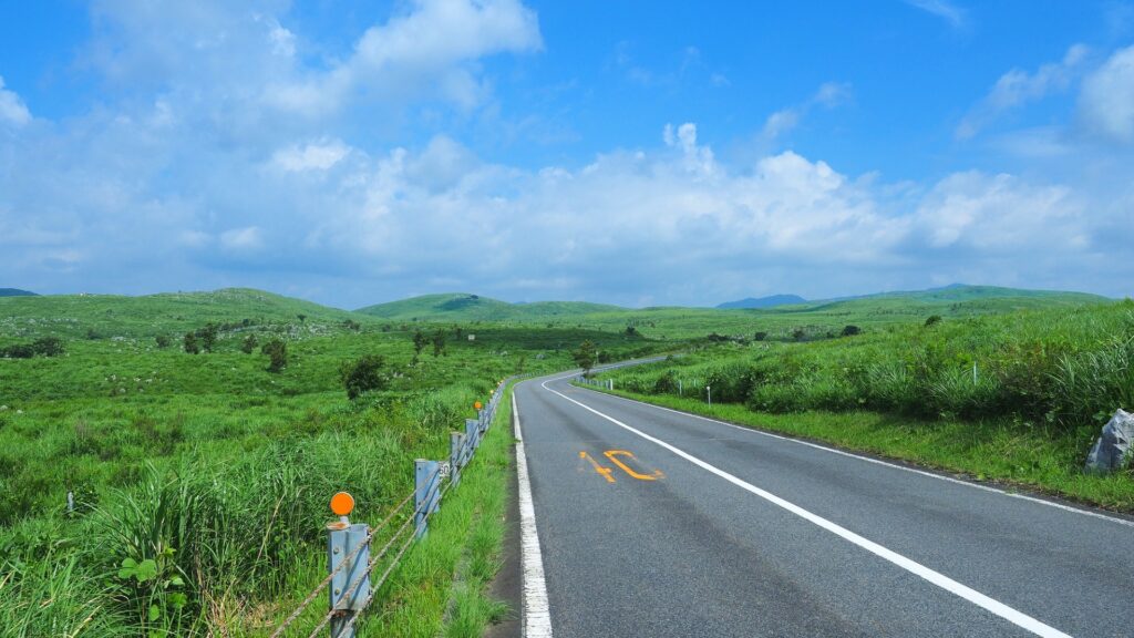
On this day, other recommended spots include Akiyoshidai Karst Observatory(秋吉台カルスト展望台)” and Akiyoshido Limestone Cave(秋芳洞)” on this day. They are 25 kilometers west of Yamaguchi City and can be reached in 30 minutes.
It is difficult to visit the next day, and if you would like to visit, please manage your schedule and visit on this day. You can enjoy breathtaking and exhilarating driving around Akiyoshidai Karst Observatory, and Akiyoshido is an overwhelmingly spectacular limestone cave compared to other caves in Japan.
Worth to visit.
Driving Map For the Day
The driving map will show an additional 10-20 spots for the day. You will travel only to your favorite spots. Click the pin on the map and input the parking MAPCODE into your car navigation system (GPS). It will guide you to the nearest parking lot for each spot!
Where to stay in Yamaguchi
The inns are concentrated northern side of Yamaguchi station and “Yuda Onsen” area located 2km west from Yamaguchi station. It is recommended to stay Yuda Onsen side.
- Inn Type
Most of these inns are reasonable Japanese Ryokan. - Parking
Most inns will offer free parking. - Onsen
This town is famous for Onsen and you can enjoy nice hot spring. - Meal Plan Reservations
There are some restaurants around the hotel for dinner, so please make reservations according to your preference.
Day 6 Yamaguchi – Hiroshima
Start: Yamaguchi (山口)
Finish: Hiroshima (広島)
Mileage:170km
Travel Pace: Fast
On this day, you’ll travel from Shimonoseki to Hiroshima via the Kintaikyo Bridge and Miyajima Island’s world-famous Itsukushima Shrine.
Miyajima offers not only Itsukushima Shrine but also many other sights, such as Mt. Misen. Please use the following as a guide for the time required.
| 3 hours | Ferry, Shrine & lunch |
| 4 hours | Ferry, Shrine, M.Misen Ropeway & lunch |
| 5.5 hours | Ferry, Shrine, Mt.Misen Ropeway, Climbing & lunch |
Because of long drives and too many attractions, the travel pace is very fast. If you would like to travel at a relaxing pace, please consider staying in Hiroshima a few more nights and visiting Miyajima the next day.
Recommended Itinerary
1
Inn in Yamaguchi
2
Mori Garden & Museum
Parking MAPCODE:
93 205 794*05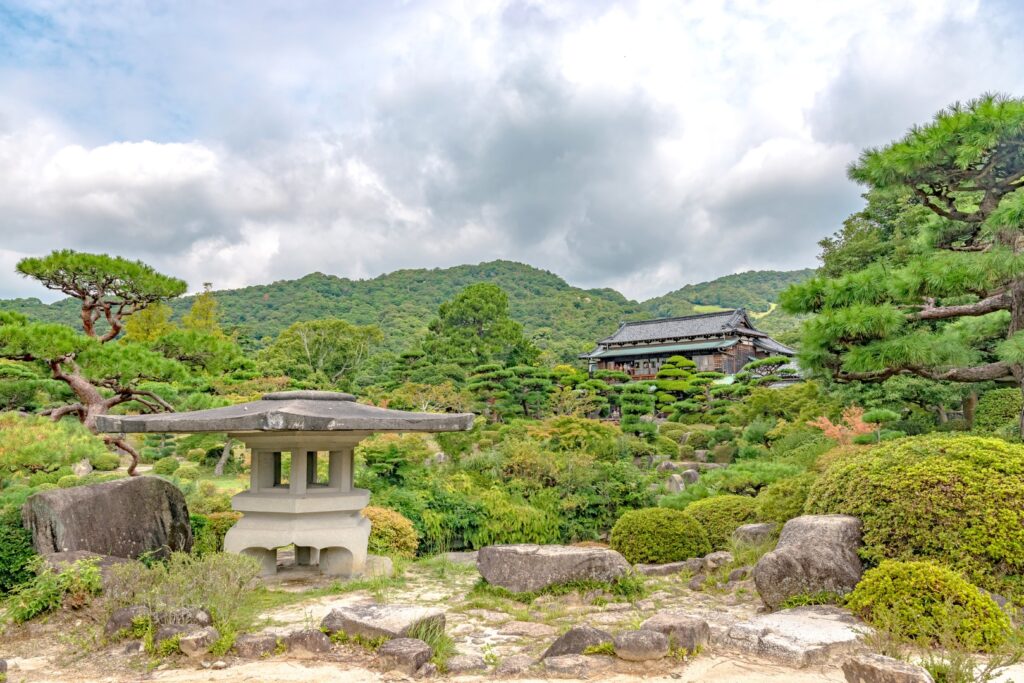
9:40
The first destination of this day is “Mori Garden & Museum.”
This garden is a model of Japanese garden design in the 19th and 20th centuries. Enjoy the tranquil atmosphere from the bridge over Hyotan Pond. Carefully trimmed shrubs and well-arranged rocks convey timeless elegance. It is one of the best places in Yamaguchi to watch the leaves turn colors during the autumn season and the cherry blossoms in the spring.
Mori Garden & Museum
60
3
Kintaikyo Bridge
Parking MAPCODE:
115 891 532*56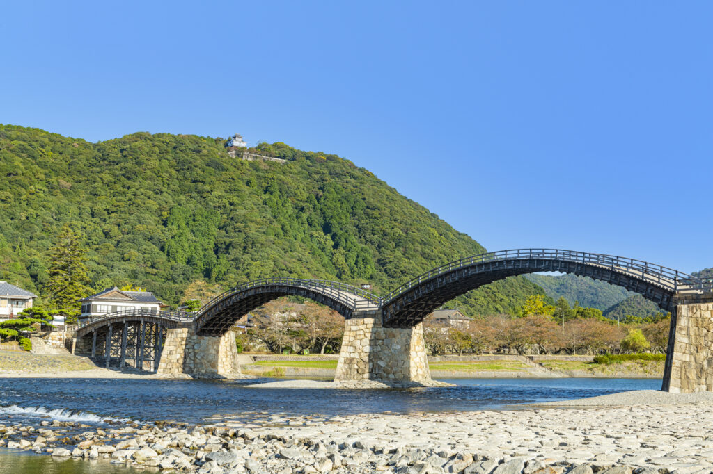
11:40
Then you will head to Kintaikyo Bridge, one of the three famous bridges in Japan. This bridge has five arches and is a rare wooden arch bridge in the world where no nails are used.
Kintaikyo Bridge
45min
4
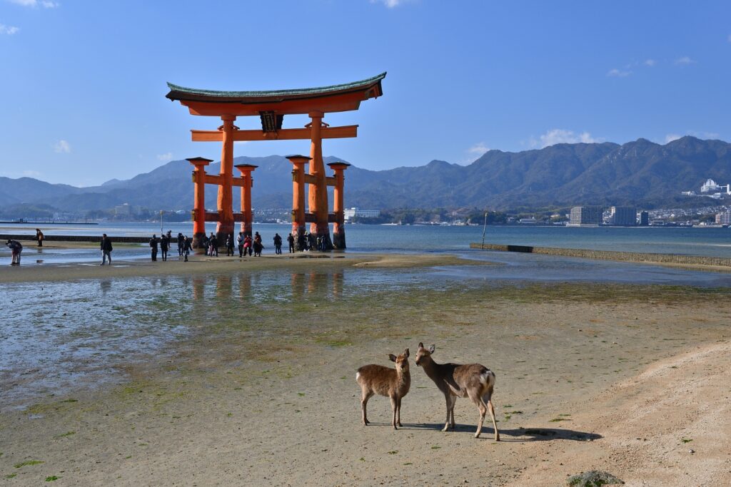
Itsukushima Shrine(Miyajima island)
Parking MAPCODE:
103 501 771*81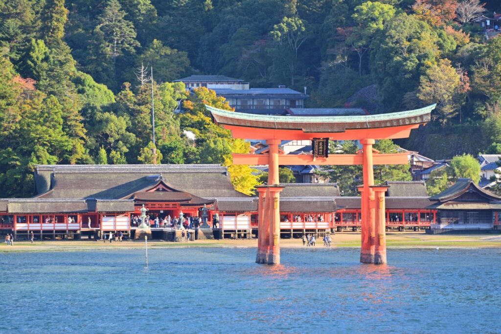
13:30
Miyajima Island, which is famous for its World Heritage Site, Itsukushima Shrine, is the highlight of this day. A vermilion-painted Otorii gate that juts out into the sea is famous as Japan’s icon.
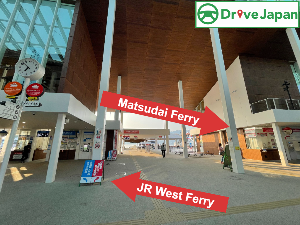
You need to take a ferry to the island. There are many parking lots at the ferry terminal, but the parking lot indicated by the MAPCODE is recommended.
There are two ferries, the JR West Ferry and the Matsudai Ferry. Both of them are almost the same, but if you want to visit Mt. Misen, Matsudai ferry and ropeway combination tickets are recommended.
| JR West Ferry | Matsudai Ferry | |
| Round Trip Fare | Adult JPY360 Child JPY180 | Adult JPY360 Child JPY180 |
| Cruise time | 10min | 10min |
| First departure | 6:25 | 7:15 |
| Feature | Ferry after 9:00 pass by the Torii Gate | JPY1800 for Ferry & Ropeway combination tickets |
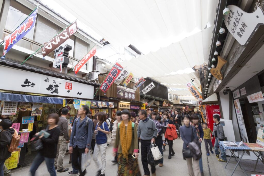
Around the shrine, there are many attractions such as Senjokaku (Toyokuni Shrine) and Omotesando Shopping Street.

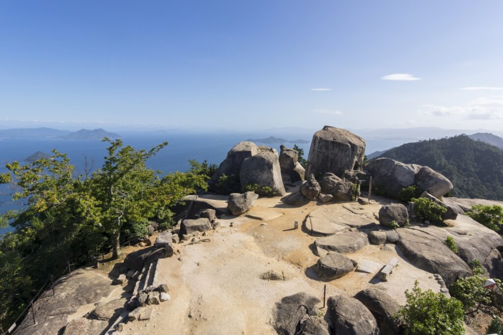
Another highlight of Miyajima is climbing Mt. Misen. At the top of the mountain, there are many natural giant rocks and unusual stones. You can also enjoy the view of Itsukushima Shrine and the Seto Inland Sea from the 360-degree panoramic observatory.
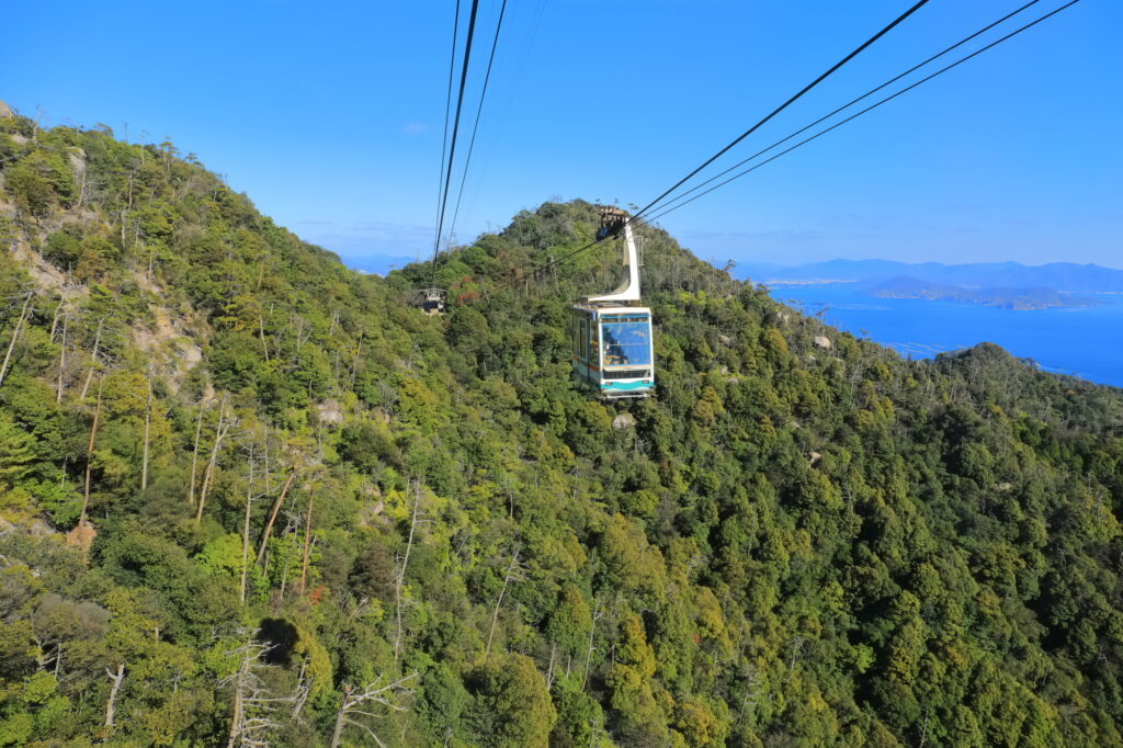
Miyajima is also a famous spot for autumn leaves in the Chugoku region. Miyajima Momijidani Park, a 5-minute walk from Itsukushima Shrine, is located at the foot of the Misen Primitive Forest, and during the season (end of October–end of November), about 700 autumn leaves color the park.
Google Town Map for Miyajima island
Itsukushima Shrine(Miyajima Ferry)
60min
Driving Map For the Day
The driving map will show an additional 10-20 spots for the day. You will travel only to your favorite spots. Click the pin on the map and input the parking MAPCODE into your car navigation system (GPS). It will guide you to the nearest parking lot for each spot!
Where to stay in Hiroshima
Hiroshima is the biggest city in the Chugoku&Shikoku area.
There are many hotels between Hiroshima Station and Peace Park. The “Hatchobori(八丁堀)” and “Nagarekawa(流川)” areas on the east side of Peace Park are downtown areas of Hiroshima, and restaurants are concentrated here. It is convenient to book a hotel within walking distance of Peace Park and the Atomic Bomb Dome.
- Inn Type
Most of these inns are reasonable western-style hotels. - Parking
Some inns have official parking but in addition to the accommodation fee, the parking lot fee will be charged separately. - Meal Plan Reservations
As many restaurants are open till midnight, it is recommended to book your inns with breakfast only or without meals.
Day 7 Hiroshima – Hiroshima Airport
Start: Hiroshima (広島)
Finish: Hiroshima Airport (広島空港)
Mileage:50km
Travel Pace: Relax
On this day, you will be returning from Hiroshima to Hiroshima Airport.
Recommended Itinerary
1
Inn in Hiroshima
2
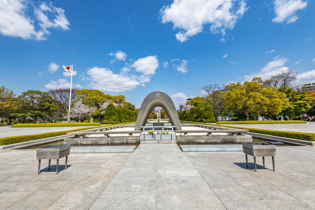
Hiroshima Atomic Bomb Dome&Peace Memorial Park
Parking MAPCODE:
22 189 461*58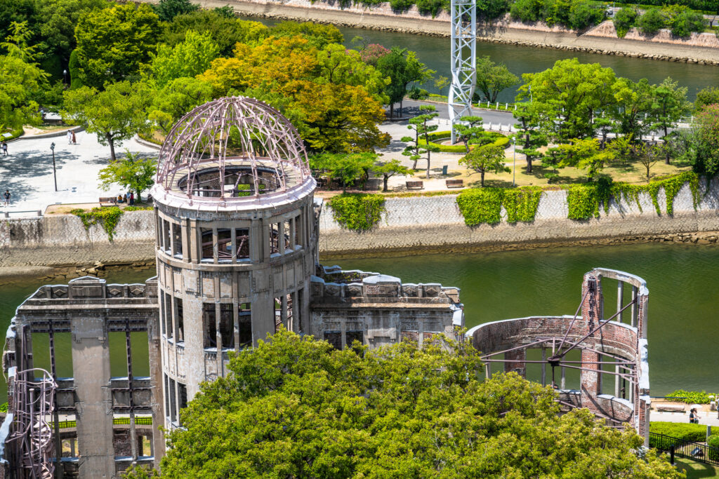
9:15
If you haven’t been to [the Atomic Bomb Dome and Peace Memorial Park] yet, be sure to visit.
It takes about 30 minutes to walk around the Atomic Bomb Dome and Peace Park, and at least an hour for the museum.
Atomic bomb dome & Peace Park map
60 min
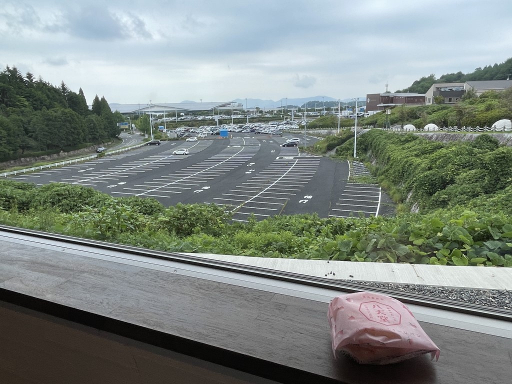
Hiroshima Airport is located 50 kilometers away from Hiroshima city.
It is recommended to take the expressway (E2) to the airport.
3
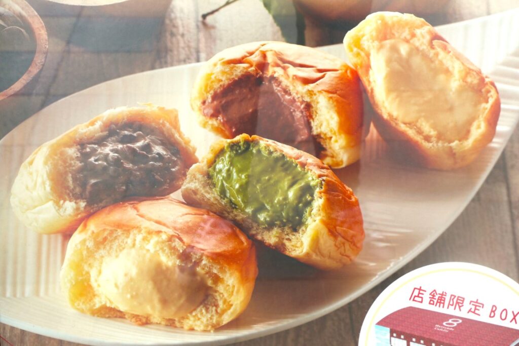
Hattendo Village
Parking MAPCODE:
257 095 02012:00
If you have time before your flight, Hattendo Village, located next to the airport, is nice to stop by.
A famous bakery that sells cream-filled rolls
Here are many attractions such as miniature ponies, athletic playground equipment, and photo spots.
Driving Map For the Day
The driving map will show an additional 10-20 spots for the day. You will travel only to your favorite spots. Click the pin on the map and input the parking MAPCODE into your car navigation system (GPS). It will guide you to the nearest parking lot for each spot!